|
A version of this photo essay appeared as an article in the August 24, 2018, edition of the Nogales International; special thanks to editor Jonathan Clark for allowing me to contribute to the local paper's coverage of the battle's centennial 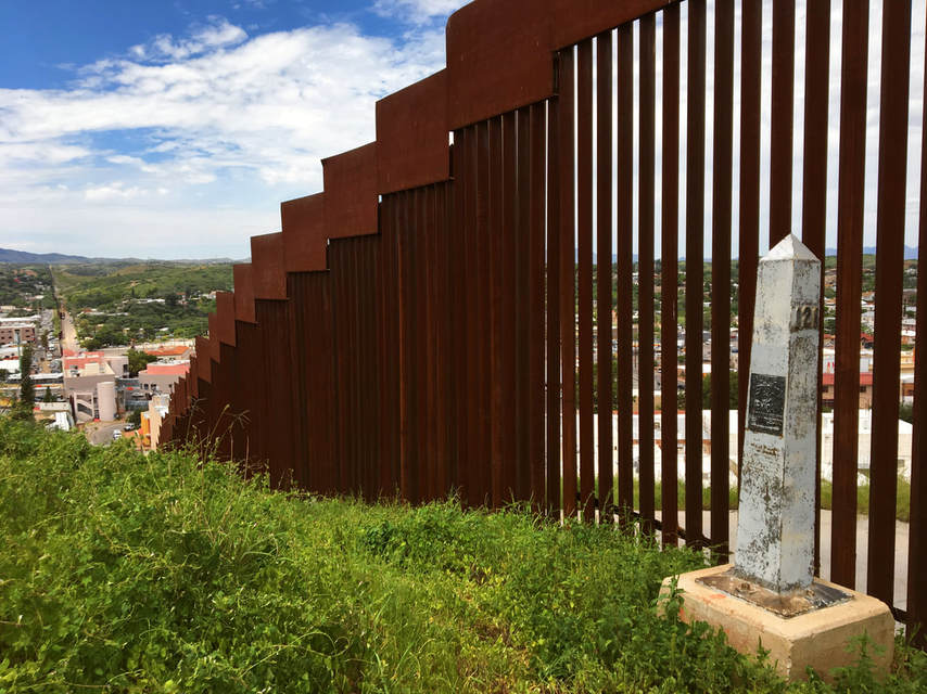 Boundary Monument 121 watches over Ambos Nogales from a high hilltop next to the U.S.-Mexico border fence. A century ago on Aug. 27, 1918, Mexicans and Americans fought one another at the Battle of Ambos Nogales, leaving as many as 129 Mexicans and four Americans dead, and approximately 330 wounded. There was another toll as well: the previously open border between Nogales, Ariz. and Nogales, Sonora. As a result of the battle, the two Nogaleses became the first cities on the U.S.-Mexico border to be divided by permanent border fences. 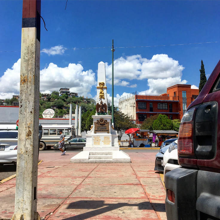 The "Monument to the Heroes" (Monumento a los Heroes) in the center of Heroica Nogales, Sonora, commemorates the Mexican citizens who died defending the city from the U.S. Army on August 27, 1918.
4 Comments
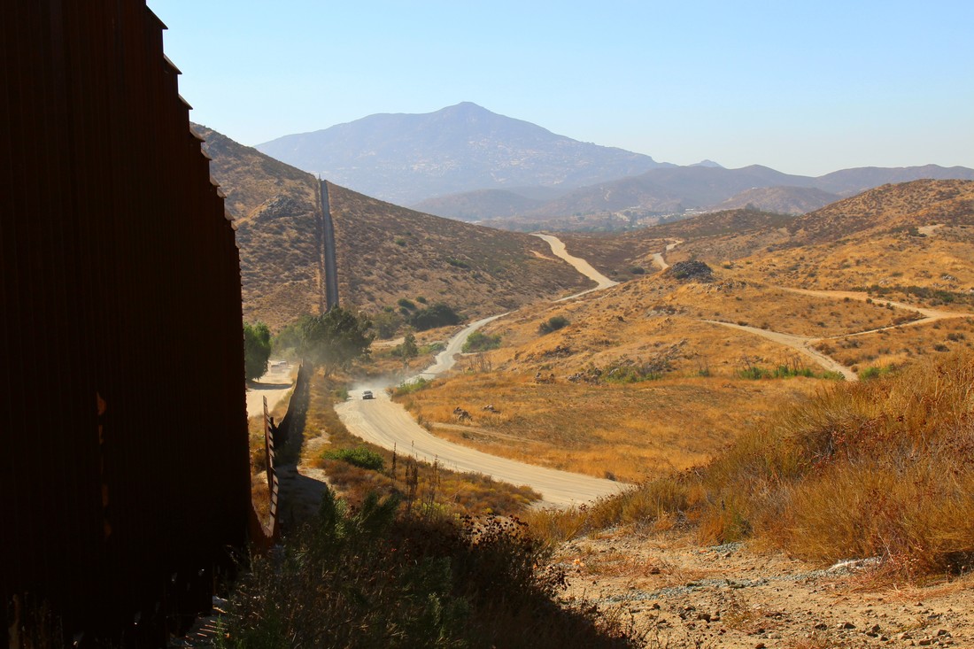 Nestled in a hot, rocky mountain area, Tecate, Baja California, Mexico and Tecate, California, USA, mark one of the meeting points between Mexican and U.S. California. Located 30 miles east of the San Diego-Tijuana zone, the two Tecates are often an alternative for travelers seeking to wait less time crossing the border. We will explore the two Tecates soon, but the dry shrubbery and rocky environment here shows the character of a slightly less-visited portion of the U.S.-Mexican border zone.
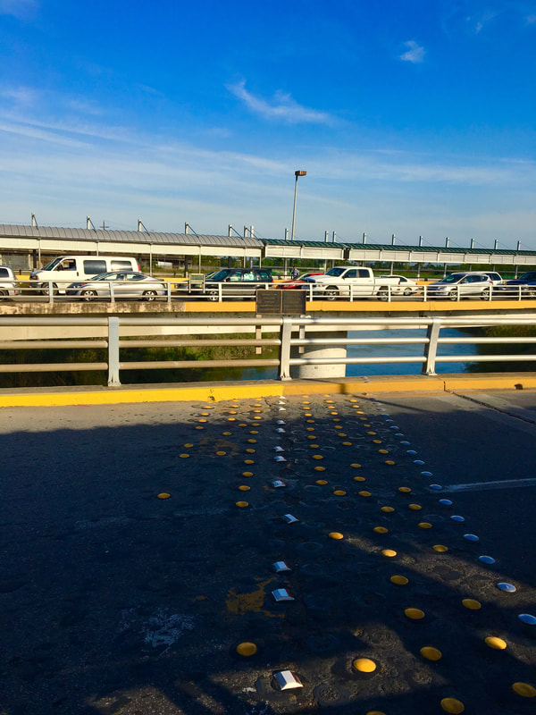
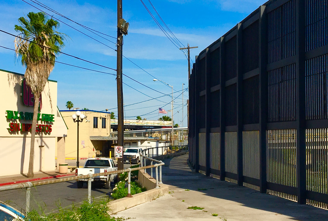 The Brownsville Gateway Port of Entry as seen from a nearby alley. The fence in this image serves to block access to the Texan bordertown from the edge of the Rio Grande (Rio Bravo). We have explored the Gateway International Bridge (AKA the “New Bridge”) and the iconic Puerta México into Matamoros and now we will explore the main U.S. port of entry into Brownsville: the Gateway Port of Entry. Situated north of the Gateway Bridge (symbolic for demonstrating the transborder ties between the U.S. and Mexico), the Brownsville Gateway Port of Entry could also be considered symbolic due to its long history. If the Puerta México welcomes us to northeastern Mexico, is the Gateway Port of Entry similarly welcoming into South Texas? 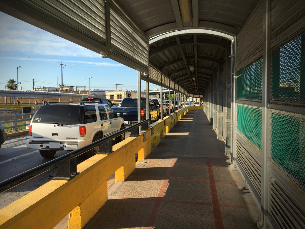 This vehicular and pedestrian crossing along the Gateway Bridge is the busiest border crossing between the sister communities of Brownsville and Matamoros. The international border is seen in the center of the image (note how the sidewalk surface changes, marking the dividing point between Mexico and the U.S.) 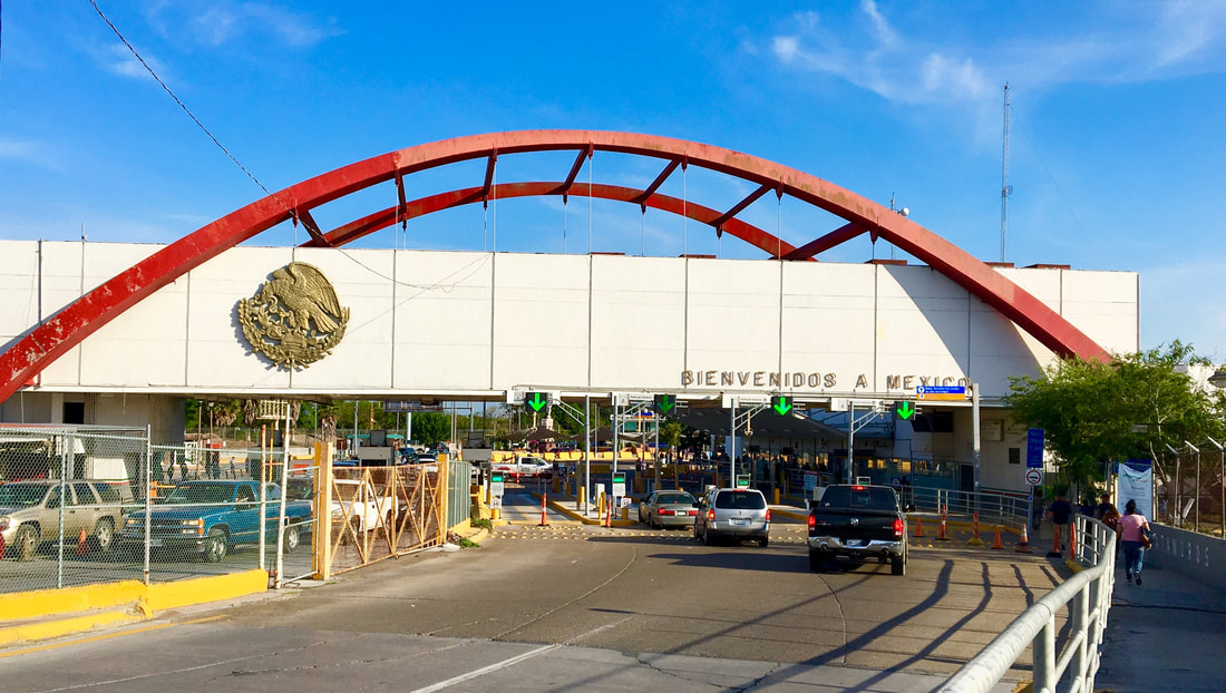 The Gateway International Bridge/Puente Internacional Matamoros (o more affectionately, the “puente nuevo”) is a symbolic and literal tie between Mexico and the United States through the border communities of Matamoros, Tamaulipas and Brownsville, Texas. In addition to appreciating the bridge’s function and symbolic value it is worth taking into consideration the sets of buildings on opposite ends of this Rio Grande border crossing, particularly in the southbound direction towards Matamoros. Just a few steps in Mexico at the foot of the bridge is one of the great architectural public buildings on Mexico’s northern border – the Puerta México or Mexico Gateway. Like the Gateway Bridge, the Puerta México has deep and tremendous historic value and symbolism.
 Situated just 25 miles (40km) from the mouth of the Rio Grande (Rio Bravo del Norte) on the Gulf of Mexico, the binational cities of Matamoros and Brownsville anchor the extreme east of the Mexico-U.S. international border. Brownsville – on the southernmost tip of Texas – and Matamoros – itself near the extreme northeast point of Mexico in the state of Tamaulipas – form a classic example of a cross-border sister city community, although in recent years the rise of narco violence on the Mexican side and the U.S. government’s desires to build more border walls in this area have gotten more attention than the rich bicultural histories of these cities. Today we will better appreciate some of this historical heritage by exploring a common, but extremely significant symbol in the Mexico-Texas border region: the symbol of the international bridge. In crossing the Gateway International Bridge (or Puente Nuevo/New Bridge) between Matamoros and Brownsville we will dust off the cob webs of another chapter in the cross-border history of Mexico and the United States. 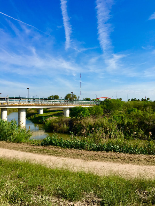 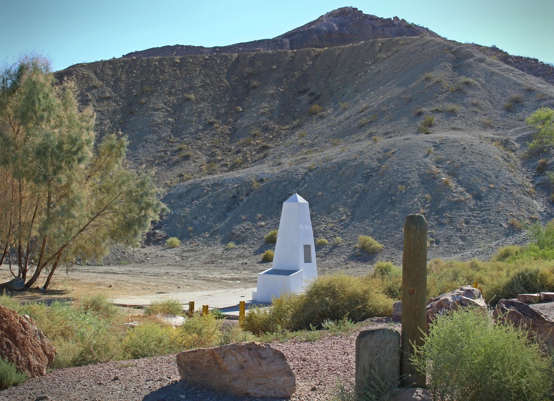 Previously when commemorating the 170th anniversary of the signing of the Treaty of Guadalupe Hidalgo we journeyed to the far western corner of the new border that the peace agreement between the U.S. and Mexico created. Surrounded by hills and beach-going crowds on the Mexican side, Boundary Monument 258 marks the U.S.-Mexico border between the corners of Tijuana and San Diego. At 258, it is the highest numbered boundary marker along the land portion of the U.S.-Mexico border which begins with Boundary Monument 1, located 700 miles to the east just outside of Ciudad Juárez-El Paso. Unlike the busy, tightly-controlled scene at Playas de Tijuana/Friendship Park, Boundary Monument 1 is in a hidden canyon along the Rio Grande and without major fence barriers. If, as some border artists have asserted, boundaries are scars on the Earth [1], this is where the wound across the desert begins.
At the close of the 2010s, Univision KMEX Channel 34 and Telemundo KVEA Channel 52 regularly compete for the highest ratings among all television viewers in Los Angeles according to the Nielsen ratings service. KMEX and KVEA’s high ratings – beating the long-established big three English-language networks – speaks to the demographic growth and vitality of the Spanish-speaking Latino American communities of the greater L.A. region. The ratings bonanza currently enjoyed by the local Univision and Telemundo stations is a dramatic counterpoint to the relatively humble, but significant technical origins of Spanish-language television in the U.S. and in Southern California more than half-a-century ago. 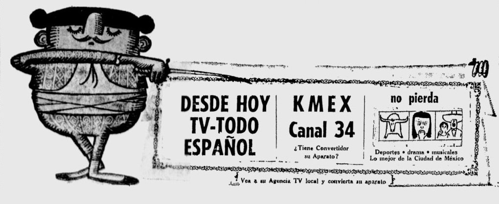 An official advertisement placed by KMEX Channel 34 in a September 1962 issue of La Opinión. Variations of this advertisement were placed in billboards around Los Angeles that fall.
 Building borders in 2011 (SOURCE, San Diego City Beat [1])
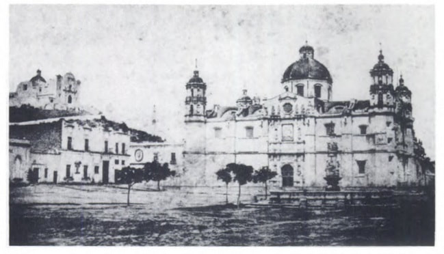 A rare photograph from 1848 depicts the Basilica of Our Lady of Guadalupe and its surrounding environment in the town of Guadalupe Hidalgo as it appeared when the famous treaty between Mexico and U.S. was signed here on February 2, 1848. According to historian Richard Griswold del Castillo, the treaty was most likely signed in one of the (since demolished) buildings to the left of Mexico's most sacred Catholic shrine, the site of the appearance of the Virgen of Guadalupe to St. Juan Diego Cuauhtlatoatzin. After the treaty was signed, the U.S. and Mexican representatives held a mass at the historic Basilica. [3] 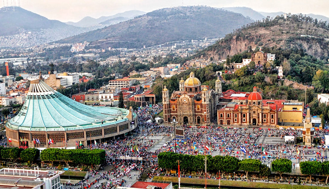 An aerial shot of the Basilica de Nuestra Señora de Guadalupe and its environs as it appears today. The original historic church [center] was opened in 1709 on the site of two older churches that occupied the sacred space after the 1531 apparitions of Our Lady of Guadalupe to St. Juan Diego. The green-roofed, circular modern Basilica was built between 1974-1976 by architect Pedro Ramírez Vázquez. To the right of the old basilica is the Capuchin Nun's Church and the Capilla del Cerro. IMAGE SOURCE: https://www.sophiatours.com.sv/uploads/image/A_Basilica.jpg While the world has changed much in the 170 years since U.S. negotiator Nicholas Trist and Mexican representatives Luis G. Cuevas, Bernardo Couto and Miguel Atristain signed the treaty – and indeed the town of Guadalupe Hidalgo now another neighborhood of Mexico City known simply as the Villa de Guadalupe – the consequences of the treaty between the two countries remain with us amid debates over Mexican/Latin American immigration and border security enforcement. 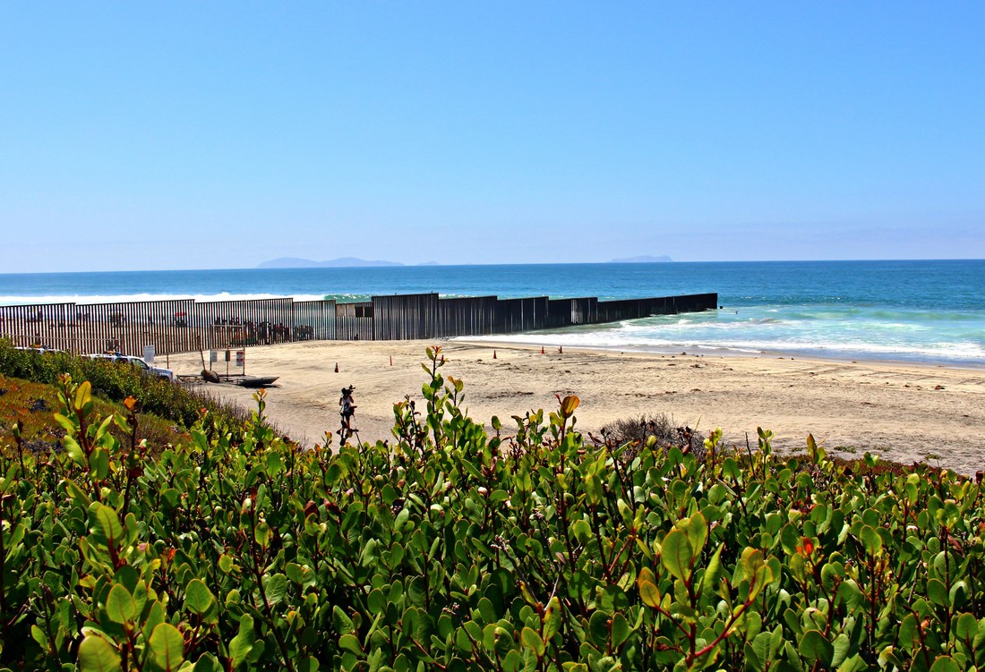 In this short photo essay, we will briefly explore the far western terminus of the U.S.-Mexican border at the “division line between Upper and Lower California" at the Pacific Ocean” - known as the "Initial Point of Boundary" between Mexico and the U.S. - to consider a small piece of the modern impact of the boundaries created by the Treaty of Guadalupe Hidalgo, signed on February 2, 1848.
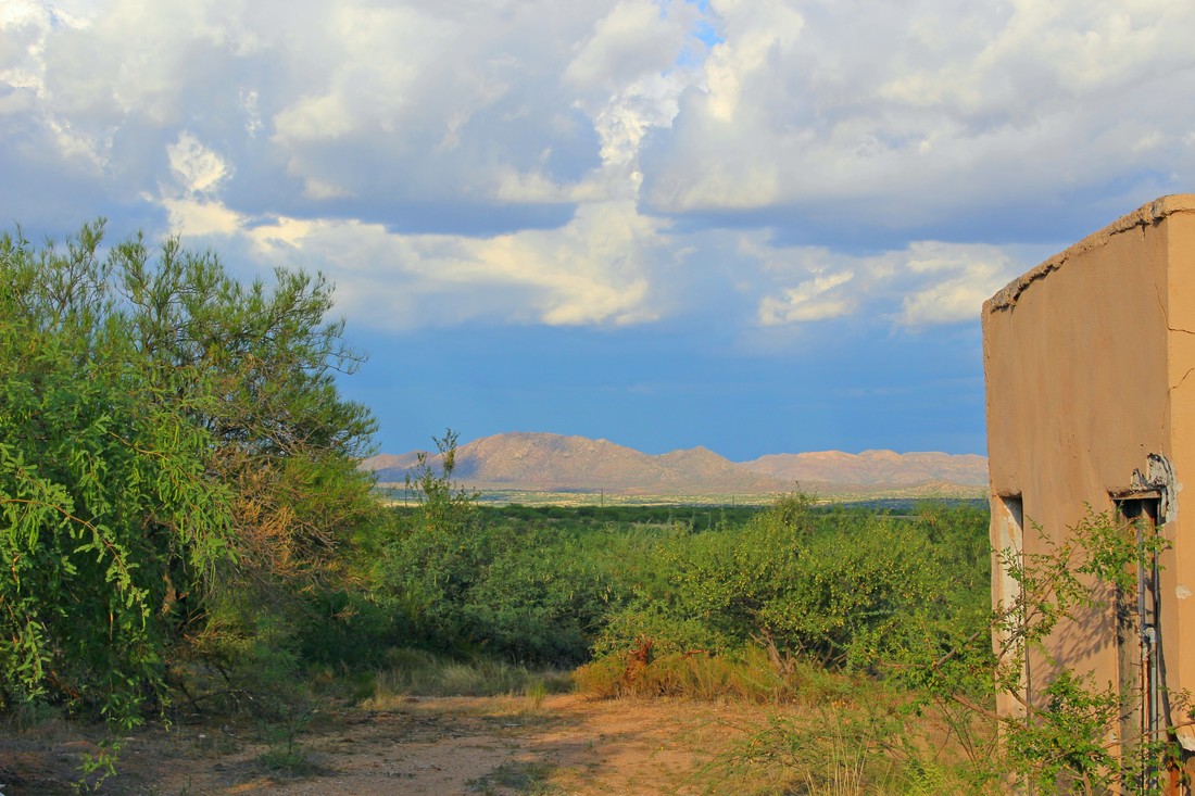 Our tour of the Altar Valley picks up at the U.S.-Mexico border crossing at Sásabe, Sonora and Sasabe, Arizona. As already mentioned, in the 2000s and early 2010s the Altar Valley corridor was the principal entry way for undocumented immigrants headed into the United States. The Altar Valley is named after the town and river of the same name in Sonora. On the northern side of the international boundary the Altar Valley – which runs from the border to the extreme western suburbs of Tucson – has few population centers. In Arizona, the Altar Valley is primarily oriented north-to-south and surrounded by the Baboquivari Mountains to the west and the Sierrita, Cerro Colorado, Las Guijas and San Luis Mountains to the east. The smuggling of people and contraband in this narrow valley greatly concerns many local and national U.S. residents.
COMMENTS: The August 27, 1918 Battle of Ambos Nogales and the First U.S.-Mexican Border Fences11/21/2017 Comment area for "The August 27, 1918 Battle of Ambos Nogales and the First U.S.-Mexican Border Fences" Online Exhibit
|
Carlos Parra
U.S.-Mexican, Latino, and Border Historian Archives
January 2021
Categories
All
|
 RSS Feed