San Clemente:
A “Voyage into the Heart of Darkness”?
Text and original photography by Carlos Francisco Parra
June 9, 2020
|
Of all the islands in the lost Mexican Archipelago of the North, San Clemente Island is the closest of the Channel Islands to the current-day U.S.-Mexico border. Although located within the Los Angeles and San Diego metropolitan areas, San Clemente Island and its cultural history, shaped by expanding national borders, is mostly unknown by people living in the dense urban centers of nearby Southern California.
|
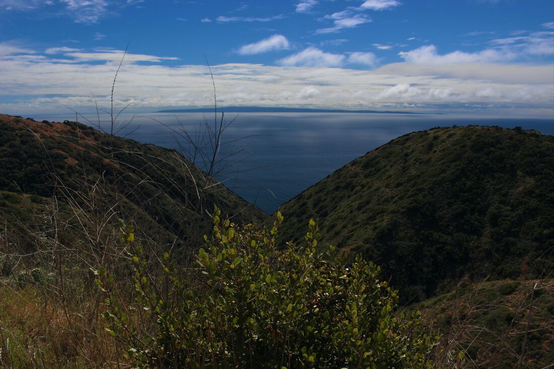
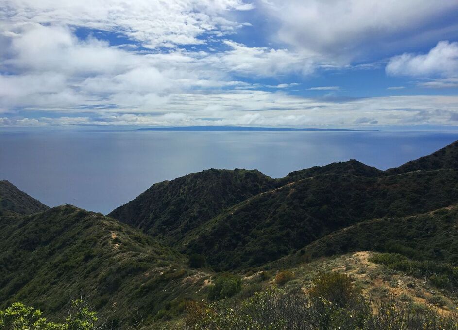
San Clemente Island as seen from the highlands of Santa Catalina Island.
|
Quick Summary:
- The Clementeño Tongva people inhabited the island for 9,000 years prior to their relocation to the Los Angeles area in the 1820s due to colonization and the expansion of Spanish-Mexican-U.S. borders
- San Clemente is the southernmost of the Channel Islands and is a major asset for the U.S. Navy as an active bombing range
- San Clemente Island has been used as a major Navy SEALs training facility
The Southernmost Point in the Lost Archipelago of the North
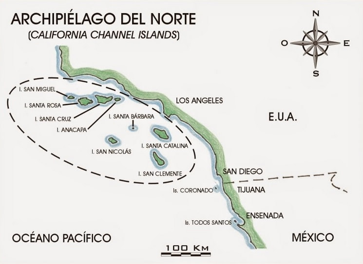
Note San Clemente Island’s proximity to the current-day U.S.-Mexican border [1]
|
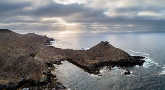
San Clemente is a narrow island approximately 21 miles (34 km) long north-to-south and 6.5 miles (10.5 km) at its widest point. A restricted property owned by the U.S. Navy, San Clemente has much in common with the numerous naval facilities in nearby San Diego 64 miles (103 km) away, but is in fact part of Los Angeles County. China Point on San Clemente’s southern shore is thus metropolitan L.A.’s southernmost point. The nearby Balanced Rock formation is the lost archipelago’s closest point to the U.S.-Mexican border 74 miles (119.5 km) to the southeast.
|

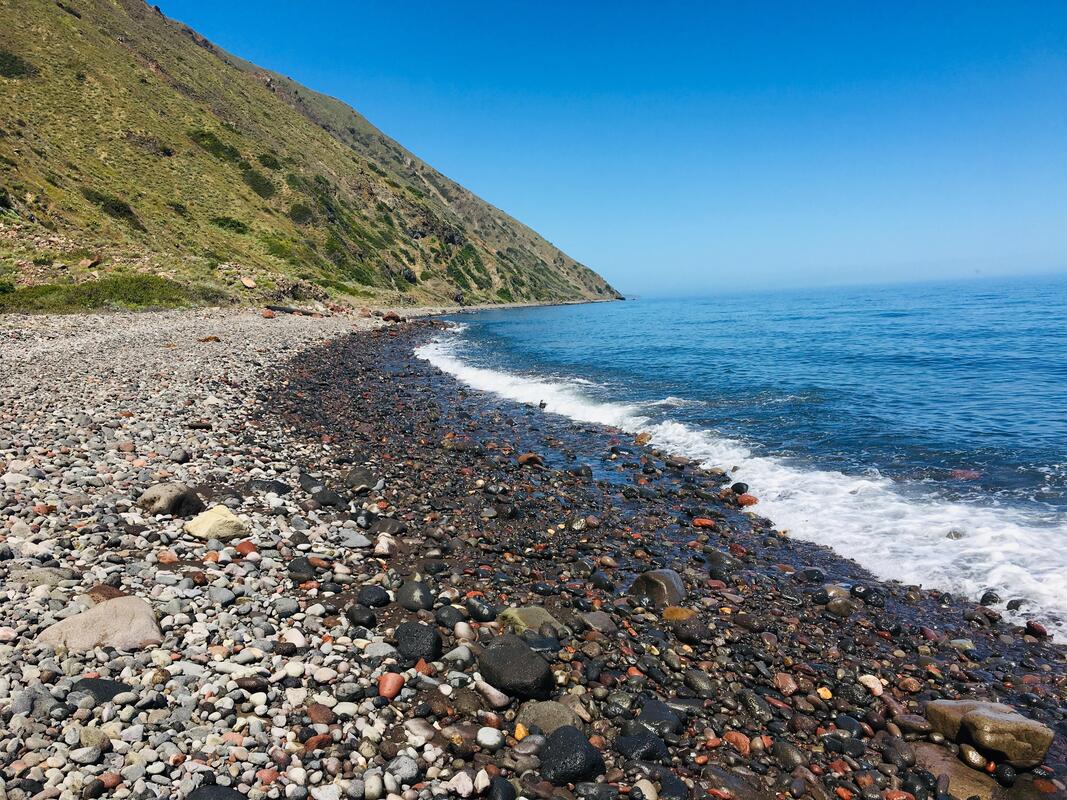
San Clemente’s southern shore. Prior to the colonization of the Californias, the native Clementeño Tongva people lived in villages around this part of the island. Photo by Phillip Colla. [2]
The U.S. Navy on San Clemente Island
In contrast to the rest of L.A. County’s crowded landscapes, San Clemente Island officially has 0 inhabitants but in reality about 300 people live and work on the island at any given time, especially around its “fake city.”
|
|
|
|
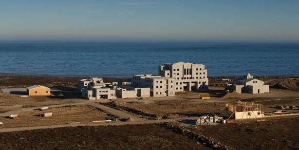
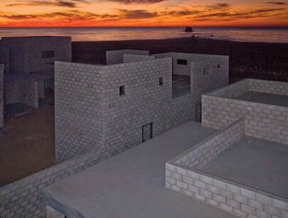
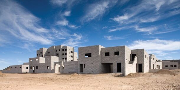
Fake city photos from Tyler Rogoway, “This Secretive Island Has Fake City For Navy SEALs To Train On,” Jalopnik (July 3, 2014). [3]
Modeled on Beirut and Baghdad, San Clemente’s “fake city” was built in the 2000s to train units for Military Operations in Urban Terrain (MOUT). The islands’ desert environment, created after years of sheep ranching in the early 1900s, adds a further Middle Eastern flair to military training in the fake city. [4]
Unlike Catalina, Santa Cruz, and Santa Rosa Islands which entered into formal private ownership during Mexican-era Alta California (which ultimately allowed them to remain publically accessible today), San Clemente fell under the direct ownership of the U.S. Government after the 1848 Treaty of Guadalupe Hidalgo. By 1934 the U.S. Navy ended all private leases and sheep ranching on San Clemente to use the whole island as a naval base.
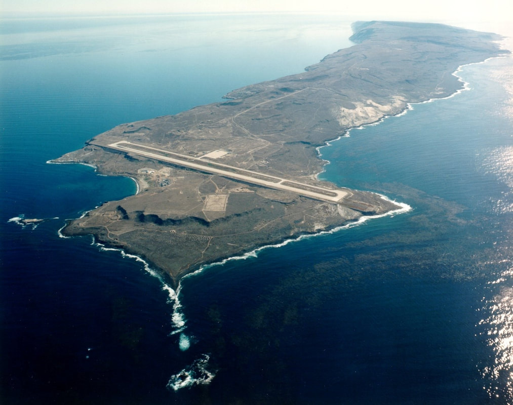
An airfield on San Clemente’s northern tip. [5]
|
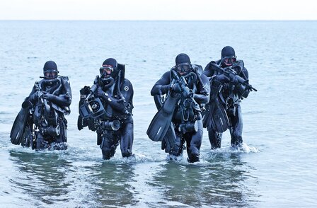
Prior to the MOUT fake city, San Clemente was used to train naval units in amphibious landing operations during World War II and today is a major Navy SEALs training center. Passing Basic Underwater Demolition/SEALs (BUD/S) training on San Clemente is one of the last challenges SEAL students must pass. According to one former SEAL, the island is an “infernal landscape” where students “voyage into the heart of darkness” as BUD/S instructors employ “free reign over the trainees, unbridled by the rules of civilized society found back on the mainland.” Amid the intense physical and psychological stress, many SEAL students have died or been injured during their training on San Clemente.
|
|
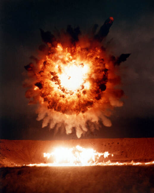
A Tomahawk cruise missile launched from a submarine 400 miles away hits its target over San Clemente during a 1986 test. Photo by U.S. Dept. of Defense. [6]
|
During the Cold War San Clemente, along with U.S. Government-owned San Miguel and San Nicolas islands, was used as a missile testing range. Today San Clemente is the U.S. military’s last active ship-to-shore firing range after local communities pushed for the end bombings exercises on Kaho’olawe Island, Hawai’i (1990), and Vieques, Puerto Rico (2003).
In contrast to the naval bombing ranges in Hawai’i and Puerto Rico, there are no local people on San Clemente to oppose the bombings’ long-term destructiveness. Although smoke from the various training exercises can often be seen 21.5 miles (35km) away on Catalina Island’s southern shoreline, for the millions of people living in nearby metropolitan Los Angeles and San Diego, bombing on San Clemente is out of sight and out of mind. [7] |
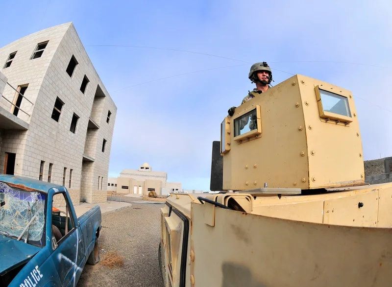
The streets of San Clemente’s MOUT “fake city.” [8]
|
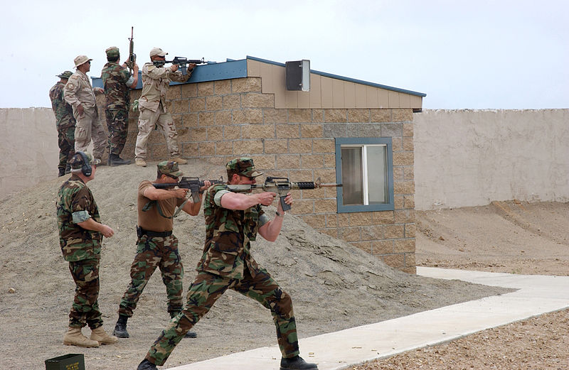
Navy SEAL training on San Clemente, described as the “heart of darkness” for being the last challenge students must pass to become SEALs. [9]
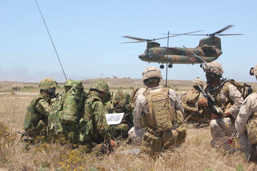
The Navy training facilities on San Clemente often host military units from nations allied with the U.S., such as Japan as seen in this photo. Although the Mexican government has never shown serious interest in regaining the islands, any modern-day Mexican claims to its lost archipelago would contend with the importance the island holds for the U.S. military. [10]
The Clementeño Tongva and Kinkipar Island
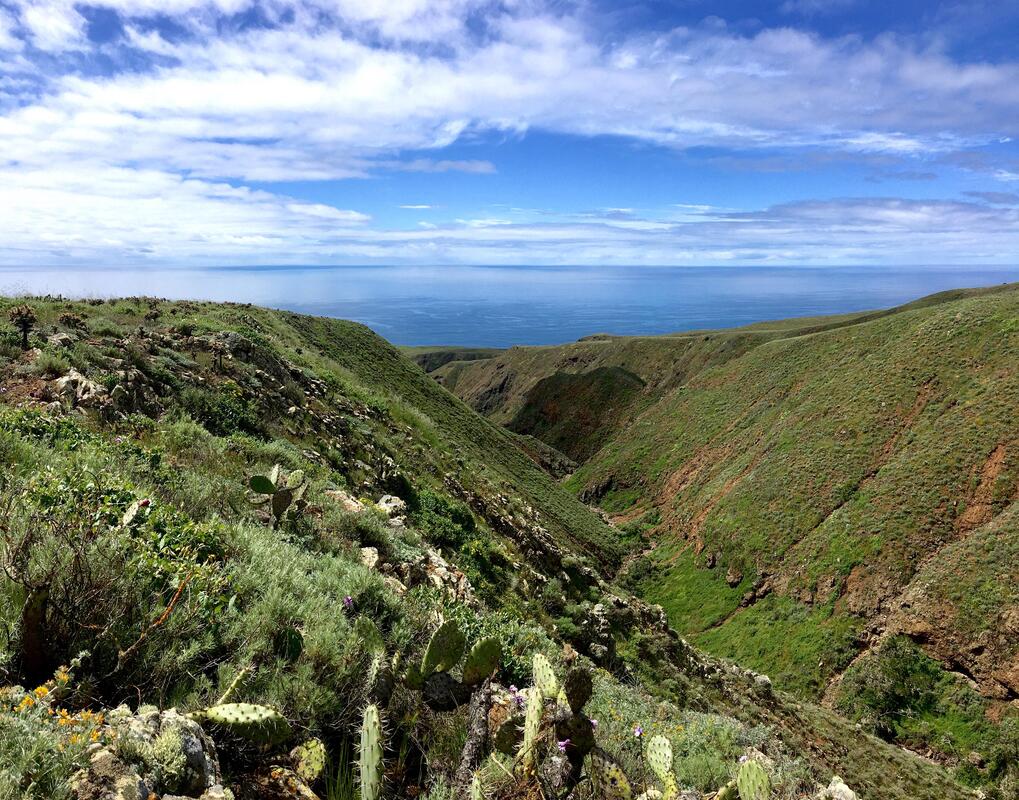
A deep San Clemente ravine. Photo by Reddit user Empidonaxed
|
Long before it became a “heart of darkness,” San Clemente first entered the minds of westerners when Spanish explorers began charting the western coast of North America in the 1540s. The Juan Rodríguez Cabrillo expedition visited in 1542, but it was the 1602 Sebastián Vizcaíno expedition which gave San Clemente its current name in 1602. When the colonization of Alta California began in 1769, a Catholic priest onboard the galleon San Antonio described the island as “a rugged land, green, with many ravines cutting deep into the sea, and no trees, save in one huge ravine, which opens out on a the beach in a small bay, where we could see small trees, and two or three Indians.”
Indeed, the island had been inhabited many millennia before Cabrillo and Vizcaino’s expeditions – the island’s indigenous people, known as Clementeños, are believed to have arrived 9,000 years ago. Anthropological research suggests the Clementeños called their island Kinkipar. [11] |
China Hat Point, photo by Aperture Photo Arts. [12]
|
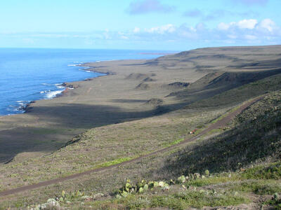
The landscape of western San Clemente Island, photo by Dan Muhs. [13]
|
The Clementeños were culturally and linguistically related to the Tongva peoples of the Los Angeles basin and neighboring Catalina and San Nicolas islands. Prior to European colonization, the Clementeño Tongva maintained a high seas trading, cultural, and religious network with the southern Channel Islands and the coast of California using ti’at canoes. Archeological research indicates the Clementeños mainly lived in villages around the southern corner of the island, but sometimes in caves as well. In other instances the Clementeños used caves as ritual burial sites, such as “Big Dog Cave” where the remains of a large dog wrapped in sea otter fur were discovered in 1939. Other sites across the island, including a pit at the Lemon Tank site where a dog, fox, and raptors were buried alongside baskets and floral offerings, show evidence of the Clementeño Tongvas’ religious practices. [14]
|
A stone carving found on the island in 2013, believed by archeologists to be a representation of a ti’at canoe, demonstrates the importance ocean voyaging held for the Clementeño Tongvas. Only 55% of San Clemente’s archeological sites have been researched so far. [15]
|
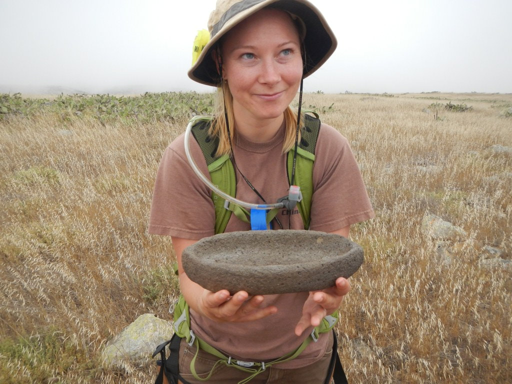
Photo from "Archeology" (https://www.archaeology.org/news/1100-130718-california-boat-effigy-volcanic-rock).
|
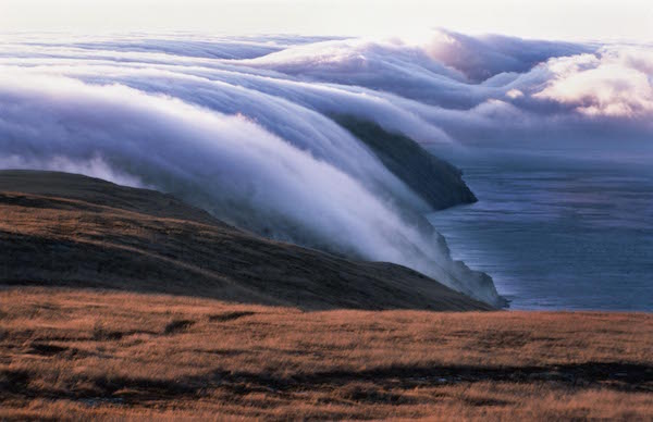
Fog over San Clemente Island. Photo by Bill Dewey, Islapedia.com. [16]
Like the native peoples of the other Channel Islands, the Clementeño Tongva abandoned San Clemente by the 1820s due to population decline caused by the introduction of diseases and the violent disruption of the Tongva cultural world by the Spanish-Mexican colonization of California after 1769. After thousands of years of continuous Tongva presence, San Clemente only became the “heart of darkness” when its people – like the Chumash and other Tongvas in the rest of the Channel Islands as well as the Apache, O’odham, and other native peoples across what is now the U.S.-Mexico border region – were displaced as Spain, Mexico, and the U.S. expanded their borders.
|
Along with the similarly displaced San Nicolas and Catalina islanders, the Clementeño Tongva relocated to the Los Angeles area where Mexican-era church and town records collectively referred to the islanders as “Pipimares.” Anthropologists have determined most of the Clementeños and other Pipimares became servants in Mexican ranches and households around Los Angeles. In the late 1820s, certain Clementeños and fellow islanders formed their own village called “la Ranchería de los Pipimares” on agricultural land located in what is today’s Downtown Los Angeles. [17]
Displaced from their ancestral islands and then also driven away from their Los Angeles Pipimares village by the 1840s, the Clementeño and other island Tongva were absorbed by the mainland Tongva people and the larger culture of Southern California. |
Prior to the colonization of the Californias, Clementeño Tongva would have fished from beaches such as this one. Photo by Reddit user Empidonaxed. [18]
|
Conclusion - A Heart of Darkness on the Maritime U.S.-Mexican Border?
From the vantage point of the Channel Islands, the creation of the U.S.-Mexican border goes far beyond whether Mexico gave up the islands in the 1848 Treaty of Guadalupe Hidalgo – the creation of that border was the continuation of powerful Spanish-Mexican-U.S. colonial projects which repeatedly displaced the indigenous peoples of the larger border region. As an isolated and grueling military training facility, its understandable why many military veterans describe San Clemente as an “infernal hellscape.” Although San Clemente is an important U.S. Navy asset, time will tell if the future allows greater public access to the island so that its 9,000 year human history can be better appreciated rather than seen as a “hellscape.” The U.S. Navy actively works with researchers to protect the island’s human and natural history, but in the canyons and beaches where the voices of Clementeño Tongva men, women, and children once rang, the echo of bomb blasts and rifle fire obscure San Clemente’s heritage, shaping it mainly as a secretive “heart of darkness.”
Suggested Reading:
Read Tyler Rogoway, “This Secretive Island Has Fake City For Navy SEALs To Train On,” Jalopnik (July 3, 2014), and accompanying comments for more first-person accounts of life on San Clemente.
About the author...
|
Carlos Francisco Parra is a doctoral candidate in history at the University of Southern California. Passionate in history and photography, he is originally from the bordertowns of Nogales, Arizona, USA, and Heroica Nogales, Sonora, México.
|
NOTES:
[1] Map by Víctor Busteros Angeles, “Día 23, jueves 5-05. Rumbo a Coronado,” Expedición al México de Ultramar (Feb. 13, 2015), (http://mexicodeultramar.blogspot.com/2015_02_13_archive.html).
[2] Philip Colla, “Sunrise at San Clemente,” Natural History Photography, (http://www.oceanlight.com/spotlight.php?img=30855); William McCawley, The First Angelinos: The Gabrielino Indians of Los Angeles (Banning, CA: Malki Museum Press, 1996), 81.
[3] Tyler Rogoway, “This Secretive Island Has Fake City For Navy SEALs To Train On,” Jalopnik (July 3, 2014), (https://foxtrotalpha.jalopnik.com/this-secretive-island-has-fake-city-for-navy-seals-to-t-1599795599).
[4] Frederic Caire Chiles, California’s Channel Islands: A History (Norman: University of Oklahoma Press, 2015), 243-247; Rogoway, “This Secretive Island,” Jalopnik.
[5] Image from San Clemente Island (http://www.scisland.org/).
[6] National Archives Identifier: 6405150, Series: Combined Military Service Digital Photographic Files, 1982 – 2007, Record Group 330: Records of the Office of the Secretary of Defense, 1921 – 2008, National Archives and Records Administration (https://catalog.archives.gov/id/6405150).
[7] Frumentarius, “Ten reasons why San Clemente Island is the batsh*t craziest part of SEAL Training,” SOFREP (July 6, 2018), (https://sofrep.com/gear/ten-reasons-why-san-clemente-island-is-the-batsht-craziest-part-of-seal-training/); “SHOBA Ship-to-Shore Bombardment Training Range - NRSW San Clemente Island Community,” MyBaseGuide (Dec. 3, 2014), (https://mybaseguide.com/installation/nrsw-san-clemente-island/community/shoba-ship-to-shore-bombardment-training-range/); Lacy Deniz, “The bombing of Kaho'olawe went on for decades. The clean-up will last generations,” Hawaii News Now (Feb. 27, 2018), (https://www.hawaiinewsnow.com/story/37604472/the-bombing-of-kahoolawe-went-on-for-decades-clean-up-will-take-generations/); Dena Trakruri, “Puerto Rico's Vieques still reels from decades of US Navy bombing,” Al Jazeera (July, 2019), (https://www.aljazeera.com/blogs/americas/2019/06/puerto-rico-vieques-reels-decades-navy-bombing-190626153309174.html).
[8] Rogoway, “This Secretive Island,” Jalopnik.
[9] “U.S. Navy photo by Mass Communication Specialist 2nd Class Pat Migliaccio/ Public domain,” Wikimedia Commons, (https://upload.wikimedia.org/wikipedia/commons/6/6f/US_Navy_070520-N-0933M-084_Members_of_Combat_Service_Support_Detachment_%28CSSD%29_1_and_CSSD-3_fire_the_M-4_rifle_at_various_moving_targets_during_a_live-fire_evolution.jpg).
[10] Rogoway, “This Secretive Island,” Jalopnik.
[11] Father Juan Vizcaíno, no relation to Sebastián Vizcaíno, of the 1769 Portolá Expedition quoted in McCawley, The First Angelinos, 79-82; “Tongva Place Names,” Tongva People (http://www.tongvapeople.org/?page_id=696).
[12] “Labor Day, 2018: Back to the kelp forest,” Aperture Photo Arts (Sept. 13, 2018), (https://aperturephotoarts.com/labor-day-2018-back-to-the-kelp-forest/).
[13] Dan Muhs, “Marine terrace San Clemente Island, California,” U.S. Geological Survey (April 23, 2006), (https://www.usgs.gov/media/images/marine-terrace-san-clemente-island-california).
[14] The Tongva mariners carved their ti’ats out of redwood logs which occasionally washed onto the island after ocean currents brought the logs down following floods in Northern California. Deborah Sullivan Brennan, “Navy Floats Stone Boat”, San Diego Union-Tribune (July 13, 2013), (https://www.sandiegouniontribune.com/news/environment/sdut-navy-boat-archeology-san-clemente-2013jul19-story.html); Caire Chiles, California’s Channel Islands, 239-240; Susan L. Morris, John R. Johnson, et al., “The Nicoleños in Los Angeles: Documenting the Fate of the Lone Woman’s Community,” Journal of California and Great Basin Anthropology vol. 36, no 1 (2016): 91-118; John R. Johnson and Sally McLendon, “The Social History of Native Islanders Following Missionization,” Santa Barbara Museum of Natural History Conference Paper (2002); McCawley, The First Angelinos, 81-82.
[15] Photo of Dr. Andy Yatsko, Senior Archeologist for the Naval Facilities Engineering Command Southwest by Shawnte Bryan in Deborah Sullivan Brennan, “Navy Floats Stone Boat”, San Diego Union-Tribune (July 13, 2013), (https://www.sandiegouniontribune.com/news/environment/sdut-navy-boat-archeology-san-clemente-2013jul19-story.html).
[16] Bill Dewey, “Fog-fall, San Clemente Island,” in “San Clemente Island Facts,” Islapedia.com (https://www.islapedia.com/index.php?title=SAN_CLEMENTE_ISLAND_FACTS).
[17] According sailor accounts cited by Frederic Caire Chiles, the Clementeño Tongva population might have been reduced to perhaps as low as 11 by 1803. Caire Chiles, 28-29, 242-243.
[18] Empidonaxed, “I’m the only person for miles — San Clemente Island, California,” Reddit (April 17, 2019), (https://www.reddit.com/r/Outdoors/comments/beet6z/im_the_only_person_for_miles_san_clemente_island/).