San Miguel:
Island of Many Kingdoms
Text and original photography by Carlos Francisco Parra
June 29, 2020
Jutting out into the fierce winds of the Pacific Ocean, San Miguel Island is the westernmost island of Mexico’s lost Archipelago of the North. For over 13,000 years the Chumash people lived on this island they called Tuqan Island amid rising seas and a changing world. When the U.S. took possession of California away from Mexico in 1848 it seemed San Miguel and the rest of the Channel Islands also became part of the U.S. However, White American ranchers claimed the island was not included in the 1848 Treaty of Guadalupe Hidalgo and proclaimed “kingdoms” on the island. The changing human story on San Miguel/Tuqan demonstrates the rich cultural history of this island of many kingdoms.
Quick Summary:
- San Miguel/Tuqan Island has been a key site in the cultural world of the Chumash people of the Central Coast region of California for at least 13,000 years
- This westernmost of the Channel Islands/Archipelago of the North has been a maritime borderland of encounters between the Chumash and European explorers, colonists, and fur hunters
- William Waters and Herbert Lester used the ambiguity of the 1848 Treaty of Guadalupe Hidalgo to claim the island was not part of the U.S. and proclaimed the unofficial Kingdoms of San Miguel
The Tuqan Chumash of San Miguel
San Miguel Island, courtesy Channel Islands National Park.
|
Long, long, before the U.S.-Mexico border existed, the Chumash people lived on San Miguel/Tuqan even before it was an island. During the last ice age approximately 13,000 years ago, ancestors of the modern-day Chumash crossed a 5-mile ocean channel by boat and inhabited a land mass which included San Miguel, Santa Rosa, Santa Cruz, and Anacapa as a single island called Santa Rosae, “California’s Atlantis.” 10,000 years ago the ancient Chumash on Santa Rosae saw a changing natural landscape as global warming led to rising sea levels submerging Santa Rosea’s lower elevations, dividing it into four separate islands. [1]
|
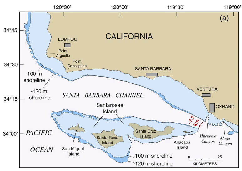
Santa Rosae, “California’s Atlantis.” [2]
The oldest human remains on what became San Miguel Island date back 10,000 years ago to when it was still part of Santa Rosae. Discovered in 2005 by University of Oregon archeologist Jon Erlandson, Tuqan Man has been identified as having died in his 40s-50s (likely making him an elder among his people). Isotope analysis revealed Tuqan Man’s diet consisted of food found along the Channel Islands as well as the interior of California, suggesting he (and others like him) often traveled between the mainland and the island.
Following the Native American Graves Protection and Repatriation Act (NAGPRA) – a 1990 U.S. law passed to stop the sort of archeological “research” which destroyed and desecrated countless indigenous village and gravesites across the Channel Islands and elsewhere – Erlandson and Channel Islands National Park worked with the Chumash to examine Tuqan Man. As Santa Ynez Chumash Tribal Chairman Kenneth Kahn remarked, “from one perspective, this is a discovery. From another, this is our ancestor.”[3]
Following the Native American Graves Protection and Repatriation Act (NAGPRA) – a 1990 U.S. law passed to stop the sort of archeological “research” which destroyed and desecrated countless indigenous village and gravesites across the Channel Islands and elsewhere – Erlandson and Channel Islands National Park worked with the Chumash to examine Tuqan Man. As Santa Ynez Chumash Tribal Chairman Kenneth Kahn remarked, “from one perspective, this is a discovery. From another, this is our ancestor.”[3]
|
|
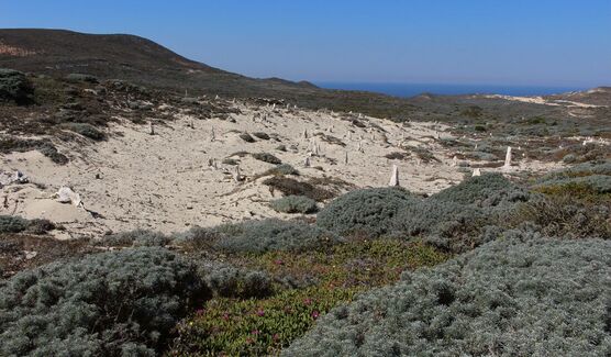
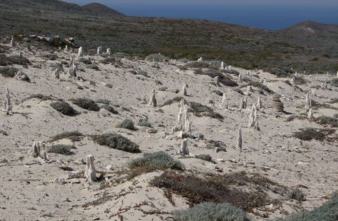
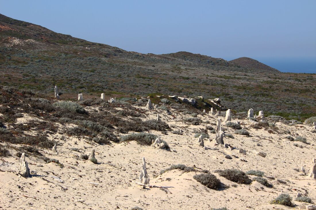
A reminder of the last Ice Age on San Miguel is the caliche forest of fossilized pine trees in the central part of the island. As the Earth warmed up, the trees died and were buried by sand. Over the course of 10,000 years, soil nutrients and rainwater created a caliche cast around the trees. Blowing winds have exposed the ancient trees’ remains for us to see today. Perhaps Tuqan Man enjoyed the shade of these trees thousands of years ago.
|

|
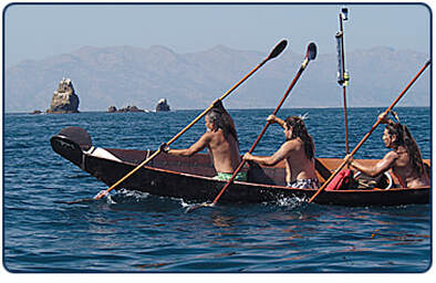
Chumash seafarers on a modern-day tomol. Photo courtesy Channel Islands National Marine Sanctuary.
|
As rising sea levels split up the islands, tomol canoes connected San Miguel/Tuqan with the larger Chumash cultural world in the rest of the archipelago and mainland California from Malibu to San Luis Obispo. Fierce ocean winds made life on the island hard, but at least two different villages (Tuqan and Niwoyomi) were in existence on the island by the time the Spanish Empire pushed its borders – the basis of the future U.S.-Mexican border – northward starting in the 1540s. Increasing contact with Spanish explorers, sailors, and colonists transformed Chumash society as diseases and colonial violence disrupted trade routes and cultural life. Evidence suggests the Tuqan Chumash left the island by 1816, relocating mainly to the Santa Ynez area, ending the historic Chumash kingdoms of San Miguel. [4]
|
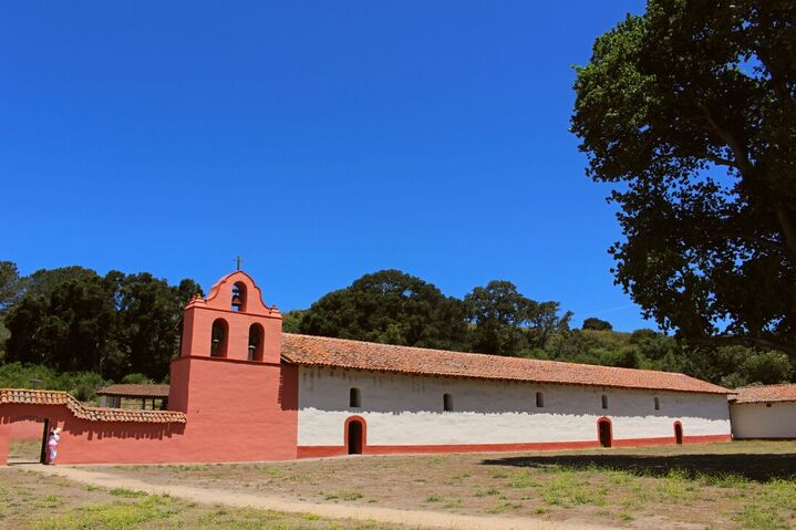
Most of the Tuqan Chumash relocated to Mission Purísima Concepción near Lompoc. The sprawling site is now a California state park.
The Kingdoms of San Miguel Island
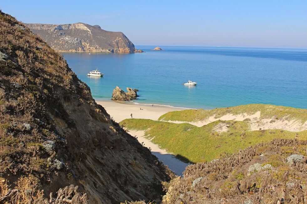
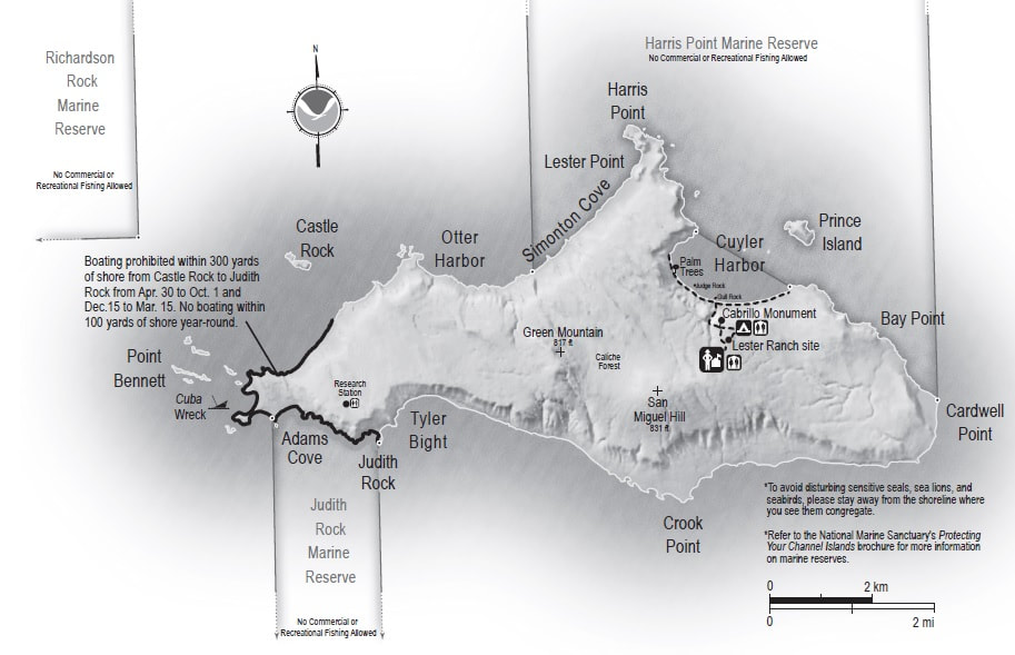
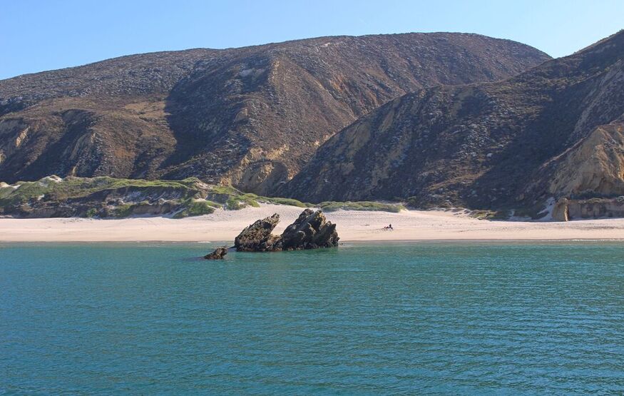
Cuyler Harbor
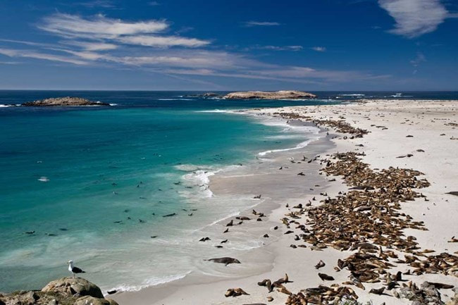
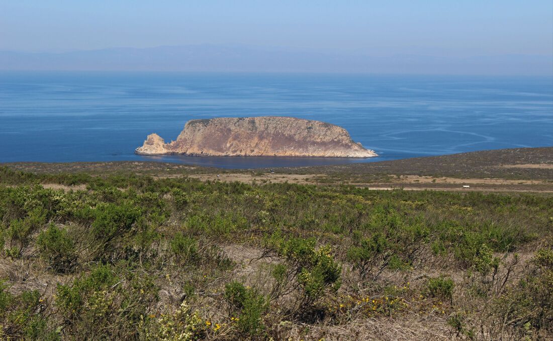
Point Bennet, site of the former Chumash village of Niwoyomi on the island’s west side, is a key breeding ground for the sea mammals Russian, British, and U.S. hunters terrorized in the 1800s. Courtesy Channel Islands National Park.
|
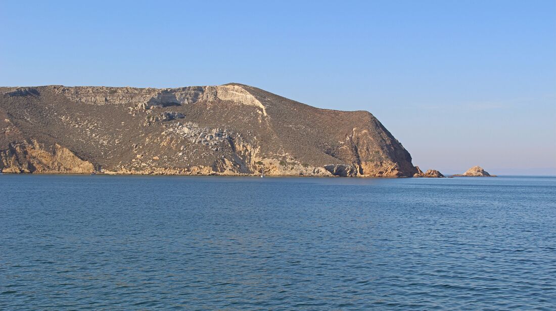
San Miguel Island did not figure prominently in Mexican-era Alta California in great part due to its isolation. Unlike Santa Rosa, Santa Cruz, and Catalina, the Mexican government did not award land grants for San Miguel. Nevertheless the waters around the island were a maritime border of sorts as Russian, Alaskan Aleutian, British, and U.S. hunters came to hunt sea otters, seals, and sea lions for their furs or organs, nearly pushing them to extinction. While seal and sea lion populations have made a dramatic recovery, sea otters are still rare in this part of the Pacific. [5]
|
The long trail to Point Bennet (Niwoyomi).
Mexico gave up Alta California to the U.S. in the 1848 Treaty of Guadalupe Hidalgo, but if the Channel Islands, unmentioned in the treaty, remained Mexican national territory San Miguel Island would be the westernmost point of the U.S.-Mexican border. Ironically, the first individual to take advantage of the archipelago’s ambiguous status was neither Chumash nor Mexican, but rather a White American veteran of the U.S. Civil War. In 1887 William Waters spent what would today be $270,000 of his wife Minnie’s money to start a sheep ranch on San Miguel. Waters proclaimed himself “King of San Miguel Island,” citing the fact that the island “was not included in the treaty made with Mexico.”
King William Waters, the first “King of San Miguel Island.” [6]
|
King William threatened to shoot “every mother’s son” (or U.S. official) who tried to enter his “kingdom” but stopped resisting the “invasion” after an armed party of surveyors escorted by U.S. Marshal Nicolás Covarrubias, a Mexican American lawman, anchored in the island’s main harbor and raised the U.S. flag for the first time on July 11, 1896. King William eventually left “his” island. [7]
|
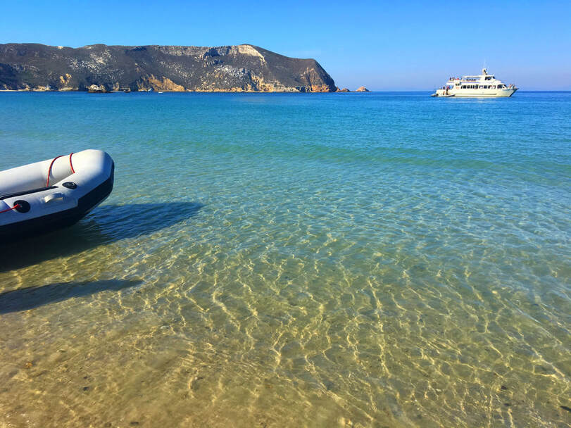
Cuyler Harbor where the U.S. flag was first raised on the island in 1896. After King William surrendered, U.S. Marshal Covarrubias invited the king onto the group’s boat where he ate “prodigiously of the good things” meant for Covarrubias’s men. [8]
|
A second, but more celebrated White American “kingdom” on San Miguel appeared in the 1930s when another rancher on the island, Herbert Lester, proclaimed himself king. A World War I veteran, King Herbert first made his way to the island to work on land leased from the U.S. government – the island’s legal owner. King Herbert found great peace living on the island with his wife Elise and young daughters Marianne and Betsy. Mail to the island was even addressed to the “Kingdom of San Miguel.”
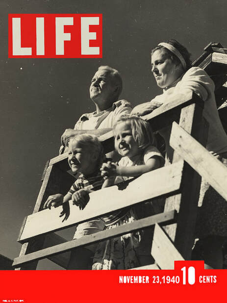
King Herbert and his “Swiss family Lester” in a 1940 Life cover story. The Lesters’ hospitality towards occasional visitors to their home – custom-built from materials salvaged from shipwrecks – earned the family much national media attention. [9]
|
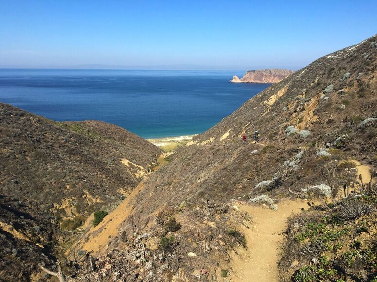
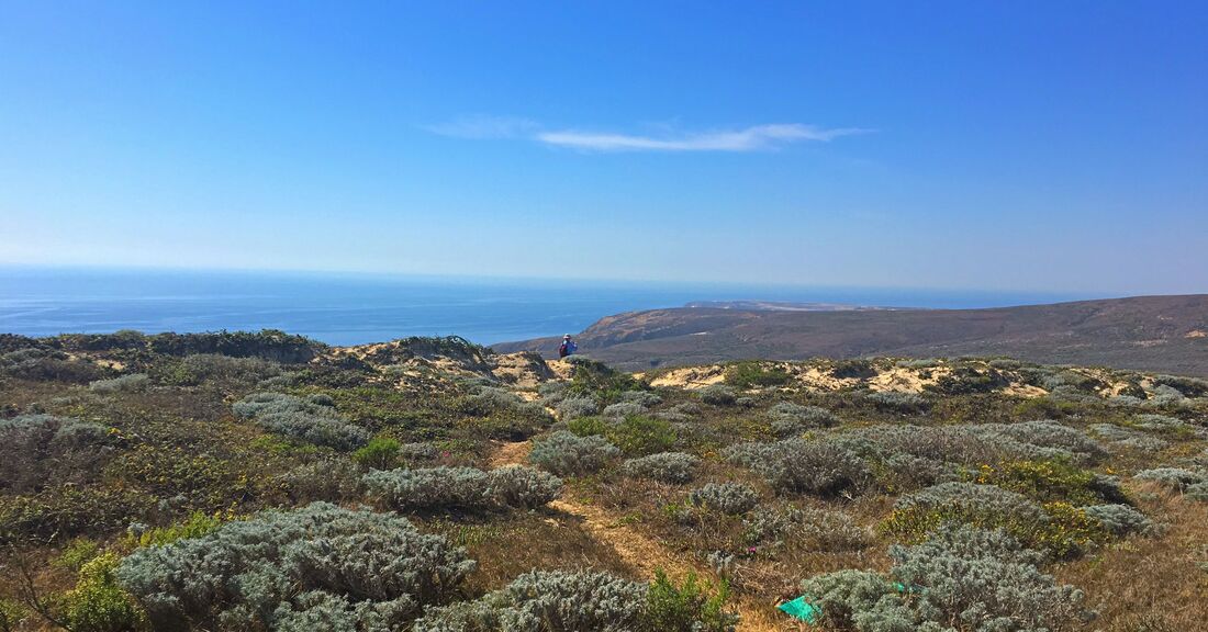
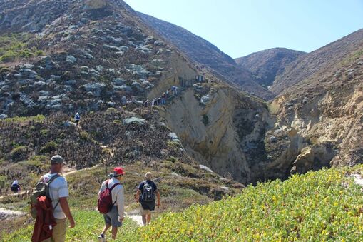
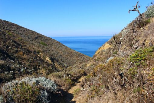
The steep hike through Nidever Canyon, a path long used by the Tuqan Chumash, is one of the roads maintained by Kings William and Herbert. The now narrow trail is a sort of border crossing visitors to San Miguel must hike between the ocean and the island's hinterlands.
|
|
|
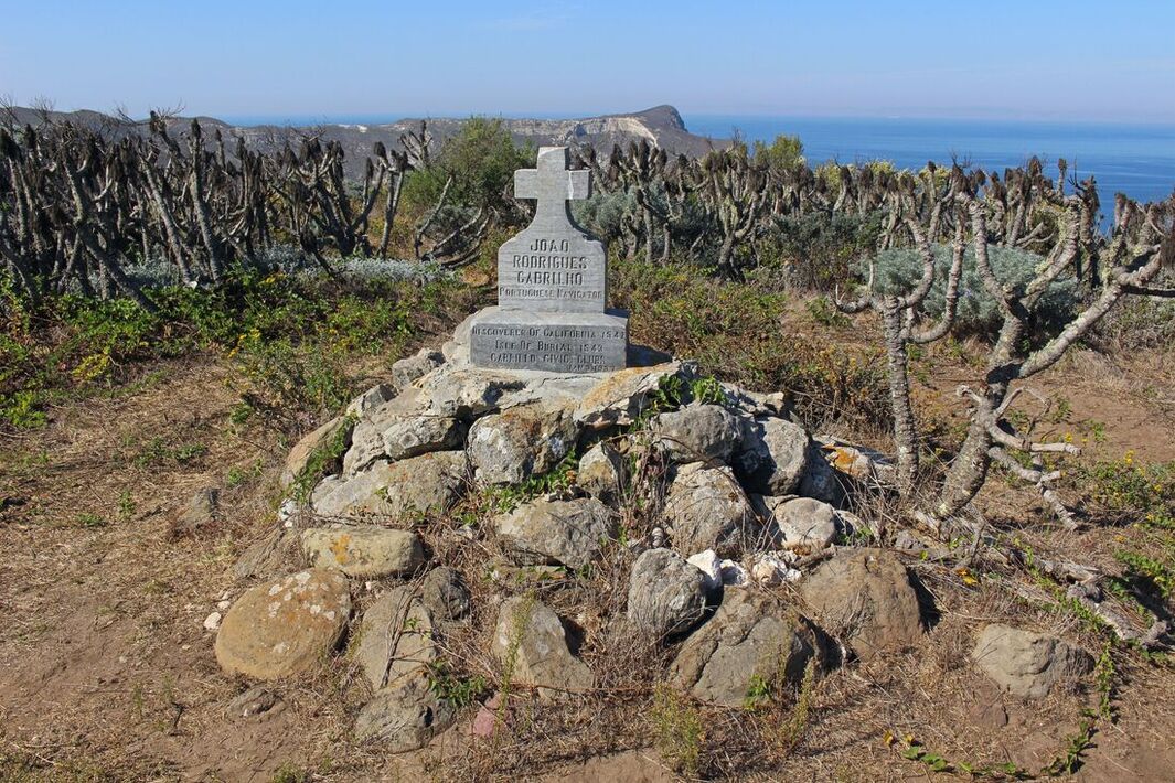
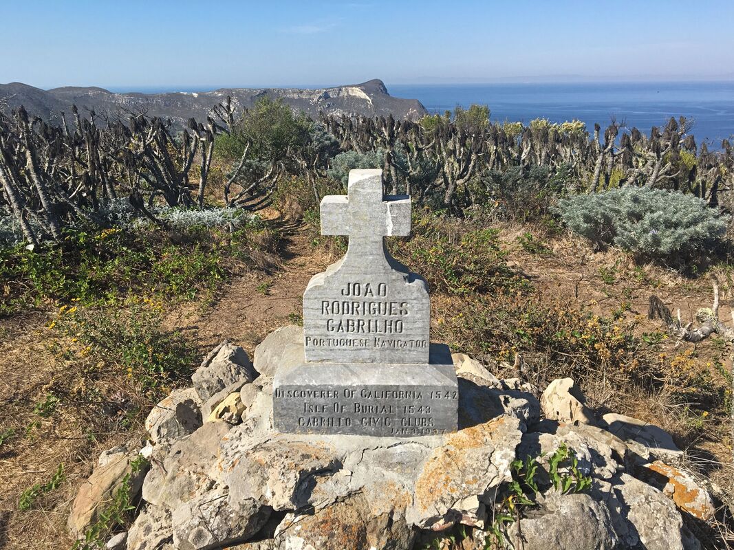
The Cabrillo Monument, one of San Miguel’s most photographed sites, is one of King Herbert’s lasting improvements on the island. The Cabrillo Civic Clubs of California worked with him to commemorate San Miguel as the final resting place of Juan Rodríguez Cabrillo, the “discoverer of California” according to the Clubs. Cabrillo’s three-ship expedition explored the region for Spain from September 1542 to early 1543, making his group the first Europeans to visit California and the first to interact with the Tuqan Chumash on October 18. Concerned that “the fame of Joao Rodrigues Cabrilho” was mostly unrecognized, the Cabrillo Civic Clubs built monuments honoring the early explorer as a way of celebrating Portuguese American cultural identity. [10]
|
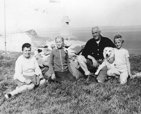
King Herbert and (left to right) Elise, Marianne, and Betsy Lester with the family dog at the Cabrillo Monument on San Miguel Island. [11]
|
Cabrillo died on January 3, 1543, but the loss of the expedition’s original reports has made it difficult to determine the exact circumstances of his death. There is as much debate as to whether Cabrillo was buried on San Miguel (or Catalina) as there is on whether he was Portuguese or a Spaniard. Nevertheless, King Herbert used the Cabrillo connection to promote the island. The Cabrillo Monument was dedicated on January 3, 1937. [12]
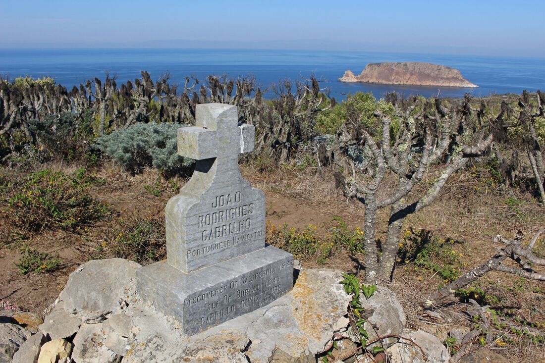
The Cabrillo Monument today, nearly 500 years after his expedition’s visit to the Californias.
|
King Herbert and his family remained on San Miguel until the U.S. Navy arrived on the island after the U.S. entered World War II. In declining health, the King of San Miguel took his own life rather than face evacuation to the mainland. Herbert Lester is buried on a high point on the northern part of the island and was joined by his wife Elise in 1981 and daughter Marianne in 2004.
|
|
Like San Clemente and San Nicolás, the U.S. Navy used the island as a bombing and missile testing range. During a bombing run, the abandoned Lester family home accidentally caught fire and burned down. By the 1970s the Navy ended its bombing campaigns on San Miguel/Tuqan and conducted ordinance clean up in anticipation of the March 5, 1980, establishing of Channel Islands National Park. [13]
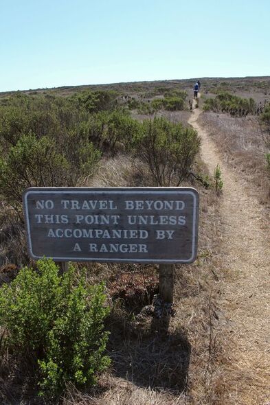
The threat of unexploded weapons materials left behind after three decades of bombing has occasionally forced the Navy to restrict access to this part of Channel Islands National Park. Visitors to San Miguel must sign waivers and be accompanied by park rangers when visiting the island’s interior. [14] |
|
Although millions of people live nearby, on average only 200 people visit San Miguel Island each year. Unpredictable ocean weather limits ferry access only to occasional day trips. Campers must stay for at least 3 days and take their own food and water due to infrequent ferry service.
Conclusion - San Miguel: Island of Many Kingdoms and Borders?
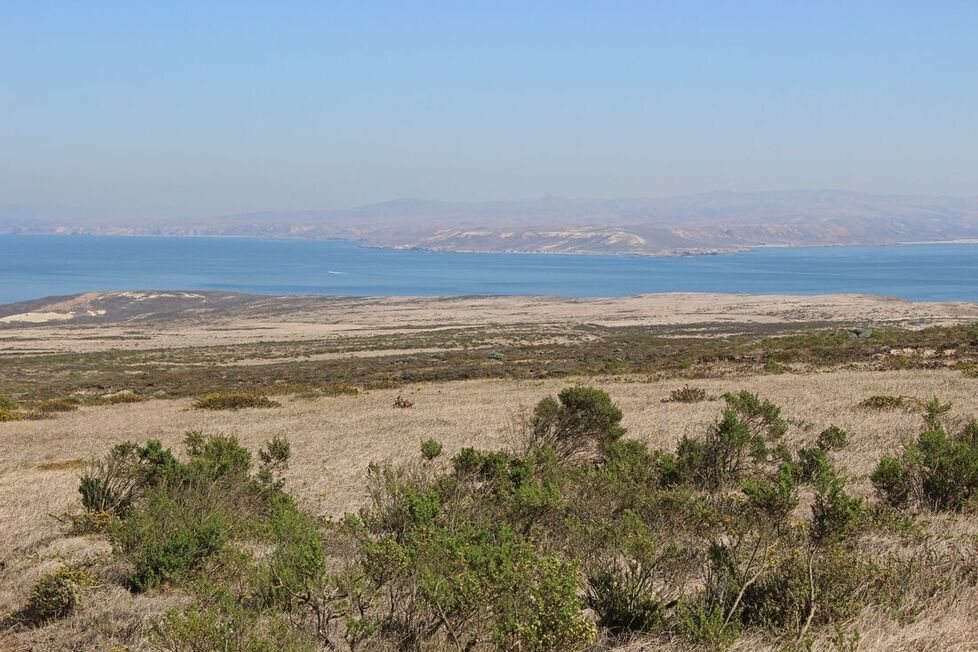
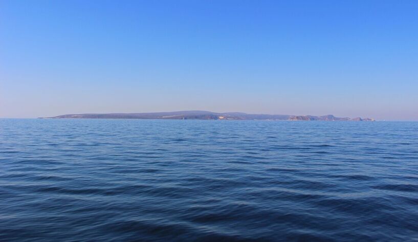
Looking east towards neighboring Santa Rosa
The May 2018 reburial of Tuqan Man symbolizes another cycle in the long history of the island of the many kingdoms. Reflecting on Tuqan Man’s return to San Miguel, Santa Ynez Chumash Tribal Chairman Kenneth Kahn said, “Protecting the final resting places of our ancestors is of paramount importance.” After 12 years of study, Tuqan Man was reburied amid chanting and the burning of white sage. [15]
While there is little continuity between the cultural world of the ancient Chumash and the rancher kingdoms of San Miguel, both represent different but linked moments in the isolated island’s history. While never contested by Mexico, the ambiguity of the Treaty of Guadalupe Hidalgo left open the possibility that the island has a destiny of its own as exemplified in the different Kingdoms of San Miguel. The different layers of human history in this harsh but beautiful maritime borderland of San Miguel/Tuqan are echoes of changing cultural boundaries in the lost archipelago.
While there is little continuity between the cultural world of the ancient Chumash and the rancher kingdoms of San Miguel, both represent different but linked moments in the isolated island’s history. While never contested by Mexico, the ambiguity of the Treaty of Guadalupe Hidalgo left open the possibility that the island has a destiny of its own as exemplified in the different Kingdoms of San Miguel. The different layers of human history in this harsh but beautiful maritime borderland of San Miguel/Tuqan are echoes of changing cultural boundaries in the lost archipelago.
Suggested Reading:
|
Jon M. Erlandson and Kevin Bartoy, “Cabrillo, the Chumash, and Old World Diseases,” Journal of California and Great Basin Anthropology, vol. 17, no. 2 (1995): 153-173.
Torben C. Rick, The Archaeology and Historical Ecology of Late Holocene San Miguel Island. Los Angeles: Cotsen Institute of Archaeology, University of California, 2007. Learn more about the Chumash people at the:
Santa Barbara Museum of Natural History Chumash Indian Museum in Thousand Oaks, CA. |
About the author...
|
Carlos Francisco Parra is a doctoral candidate in history at the University of Southern California. Passionate in history and photography, he is originally from the bordertowns of Nogales, Arizona, USA, and Heroica Nogales, Sonora, México.
|
NOTES:
[1] “Geologic Formations,” Channel Islands National Park – National Park Service (https://www.nps.gov/chis/learn/nature/geologicformations.htm); Nathan Masters, “California’s Atlantis: The Lost Superisland of Santarosae,” KCET (Aug. 7, 2018), (https://www.kcet.org/shows/lost-la/californias-atlantis-the-lost-superisland-of-santarosae).
[2] Image from Masters, “California’s Atlantis: The Lost Superisland of Santarosae,” KCET.
[3] Cheri Carlson, “Tuqan Man, human remains buried 10,000 years ago, found on the Channel Islands,” Ventura County Star (June 13, 2018), (https://www.vcstar.com/story/news/special-reports/outdoors/2018/06/13/ancient-remains-discovered-reburied-san-miguel-island-tuqan-man-channel-islands-santa-ynez-chumash/670609002/).
[4] Initially, most of the San Miguel Chumash people relocated to Mission La Purísima Concepción then to what is now the Tejon Indian Community and the Santa Ynez Indian Reservation. John R. Johnson and Sally McLendon, “The Social History of Native Islanders Following Missionization,” Fifth California Islands Symposium, 29 March to 1 April 1999, Volume: 2 (https://www.researchgate.net/publication/236686546_The_Social_History_of_Native_Islanders_Following_Missionization); Deana Dartt-Newton and Jon M. Erlandson, “Little Choice for the Chumash: Colonialism, Cattle, and Coercion in Mission Period California,” American Indian Quarterly, vol. 30, no. 3 (Summer 2006): 416-430; and Torben C. Rick, The Archaeology and Historical Ecology of Late Holocene San Miguel Island (Los Angeles: Cotsen Institute of Archaeology, University of California, 2007): 95-96. Tomol photo by Robert Schwemmer in Roberta R. Cordero, “Full Circle Chumash Cross Channel in Tomol to Santa Cruz Island,” NOAA Channel Islands National Marine Sanctuary (https://channelislands.noaa.gov/maritime/chumash3.html).
[5] Todd Braje, “When Marine Mammals Clash With Archaeological Heritage,” Sapiens (March 12, 2020), (https://www.sapiens.org/archaeology/san-miguel-island-sea-lions/); “Northern Elephant Seal,” Channel Islands National Park (https://www.nps.gov/chis/learn/nature/elephant-seal.htm).
[6] Prior to Waters, several squatters took possession of San Miguel but did not have formal legal title to it (the U.S. government was the island’s property owners). Frederic Caire Chiles, California’s Channel Islands: A History (Norman: University of Oklahoma Press, 2015): 34-35; Image from “Waters, William G.,” Islapedia (https://www.islapedia.com/index.php?title=WATERS,_William_G).
[7] “Santa Barbara County: From San Miguel,” Los Angeles Times (July 12, 1896), pg. 29; “July 8, 1896 Santa Barbara Daily News,” in “Waters, William G.,” Islapedia (https://www.islapedia.com/index.php?title=WATERS, William_G); and Chiles, California’s Channel Islands: 38-39.
[8] Stella Haverland Rouse, “The Waters Family of San Miguel,” Noticias, vol. 23, no. 3 (Fall 1977):43-52.
[9] “The Legendary King,” West of the West: Tales from California’s Channel Islands
(http://www.teachchannelislands.org/tales/the-legendary-king).
[10] Cabrillo Civic Clubs (http://www.cabrillocivicclubs.org/aboutus.asp), (accessed June 26, 2020).
[11] Matt Kettmann, “Uncovering the Channel Islands’ Unique Histories,” Santa Barbara Independent (May 7, 2015), (https://www.independent.com/2015/05/07/uncovering-channel-islands-unique-histories/).
[12] Cabrillo is believed to have developed gangrene after he splintered his shin slipping on sharp rocks on one of the Channel Islands. Prior to his death in the Archipelago of the North, Cabrillo accompanied conquistadors Hernán Cortés and Pedro de Alvarado during the violent conquests of Mexico and Guatemala, respectively.
[13] Chiles, California’s Channel Islands: 45-49; Brett Johnson, “Sweet Memories of San Miguel,” Ventura County Star (August 24, 2008), (http://archive.vcstar.com/news/sweet-memories-of-san-miguel-ep-373233323-352481841.html).
[14] Juliet Bennet Rylah, “Beautiful and Remote San Miguel Island Will Reopen to the Public,” LAist (May 4, 2016), (https://laist.com/2016/05/04/san_miguel_island.php); Katia Hetter, “California island used as bombing range reopens to public,” CNN (May 6, 2016), (https://www.cnn.com/travel/article/san-miguel-channel-islands-national-park-reopens/index.html).