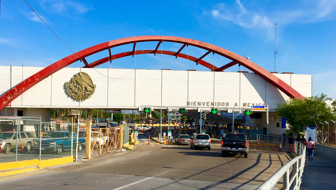
 The Gateway International Bridge/Puente Internacional Matamoros (o more affectionately, the “puente nuevo”) is a symbolic and literal tie between Mexico and the United States through the border communities of Matamoros, Tamaulipas and Brownsville, Texas. In addition to appreciating the bridge’s function and symbolic value it is worth taking into consideration the sets of buildings on opposite ends of this Rio Grande border crossing, particularly in the southbound direction towards Matamoros. Just a few steps in Mexico at the foot of the bridge is one of the great architectural public buildings on Mexico’s northern border – the Puerta México or Mexico Gateway. Like the Gateway Bridge, the Puerta México has deep and tremendous historic value and symbolism. 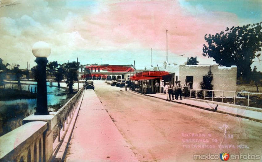 If we had crossed the Gateway Bridge between 1928-1949 we would have encountered the Mexican customs house in the small building on the right. Note the character of the aduana (customs house) with its adobe and traditional appearance. The bridge and building were built on the spot of the historic Santa Cruz “Garita” or Port of Entry. [1] 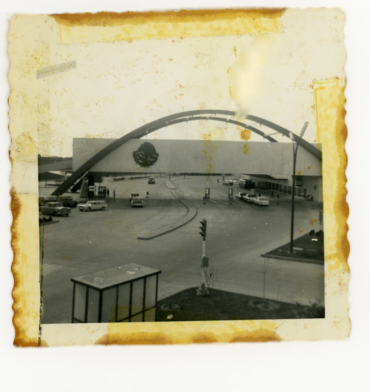 The Puerta México complex shortly after its 1962 dedication – note the port of entry’s openness in its first years. [2] 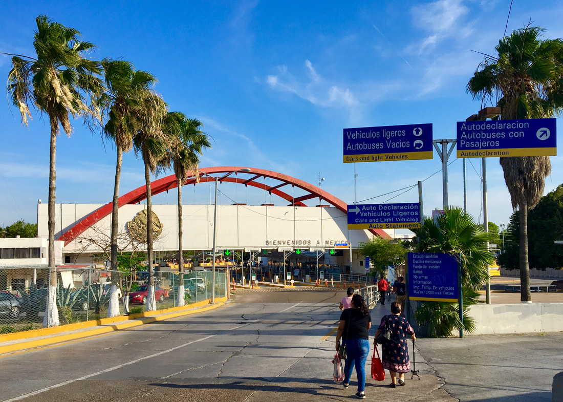 Heading southbound today we cross the Mexican port of entry housed within the modernist “Puerta México” designed by Mario Pani Darqui, the most celebrated Mexican architect of the 20th century. Pani Darqui, a practitioner of functionalist architecture, included two steel arches in his Puerta México to extend a sense of welcome to whoever entered into Matamoros through this building. In functionalist architecture buildings are supposed to be designed solely for the building’s purpose and should express its function. Traditionally arches have represented “welcome symbols” for travelers. The Puerta México’s steel arches support the Mexican National Immigration Institute and customs offices, reflecting the design’s symbolism and functionality. 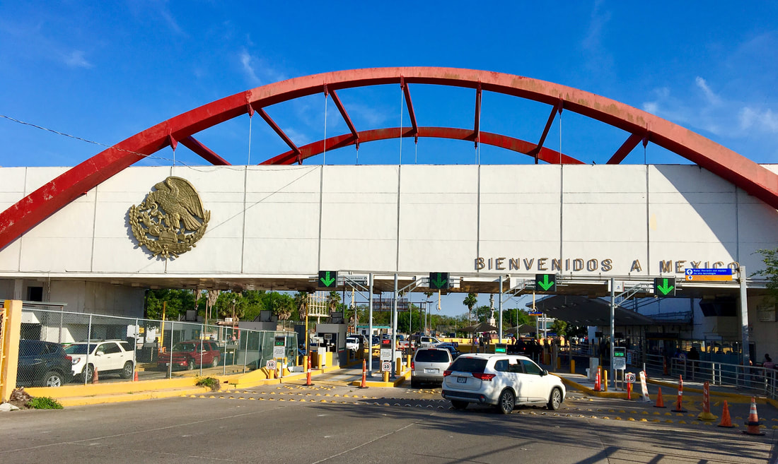 The Puerta México’s functionalist arches look like open arms outstretched to whoever crosses the Gateway International Bridge. 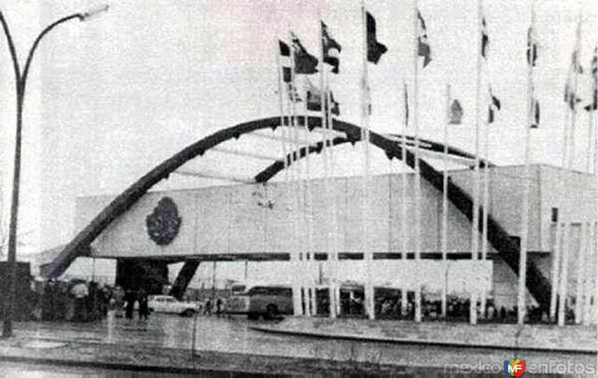 The Puerta México shortly after its 1963 dedication – note the array of flags representing the different American republics on the outside of the immigration and customs building. [3] 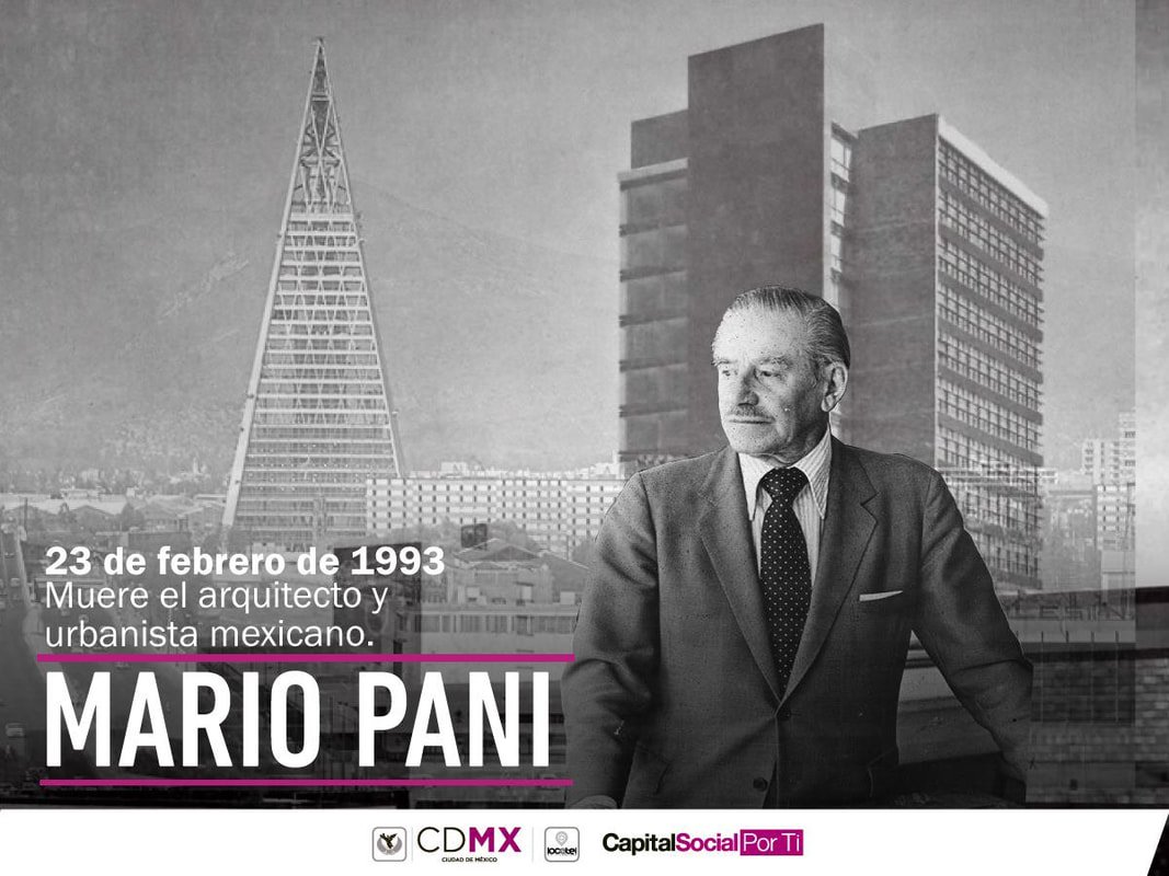 In this banner shared on the anniversary of Mario Pani’s death we can see some of the famed architect’s works, including the Tlatelolco Tower in Mexico City. [4] 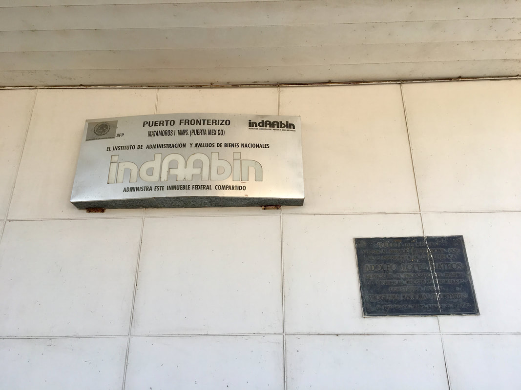 Underneath the archway entrance one can glimpse a sign that indicates the international bridge’s official name and the government body which administers the bridge and port of entry (IndAAbin, or the National Buildings Appraisal and Administration Institute) of Mexico’s Secretariat of Civil Services (Secretaría de la Función Pública). Next to the sign we can also see a plaque commemorating the Puerta México’s dedication in January 1963. 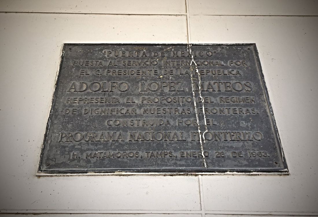 “’Puerta México’ launched into international service by Adolfo López Mateos, President of the Republic, represents the government’s purpose of dignifying our borders. Constructed by the National Border Program. Heroica Matamoros, Tamaulipas, January 26, 1963.” López Mateos’s administration left a deep imprint throughout the Mexican border with his National Border Program (or PRONAF, Programa Nacional Fronterizo) which worked to beautify Mexico’s different bordertowns in order to attract greater foreign investment and tourism. Mario Pani spearheaded many PRONAF projects, designing a variety of buildings and other projects for bordertowns like Piedras Negras and Heroica Nogales. We will return to PRONAF and Mario Pani’s work in the future. Northbound across new bridges 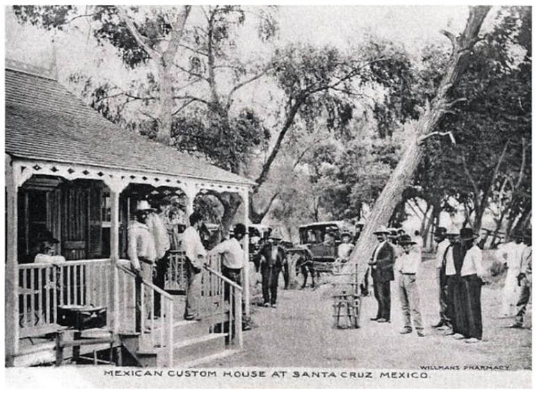 Now that we have seen how the entryway into Mexico looks like today via this historic border crossing, we will head northbound through the 19th, 20th, and 21st centuries. In this northward-facing image we can observe the Santa Cruz Port of Entry in the late 1800s. [5] 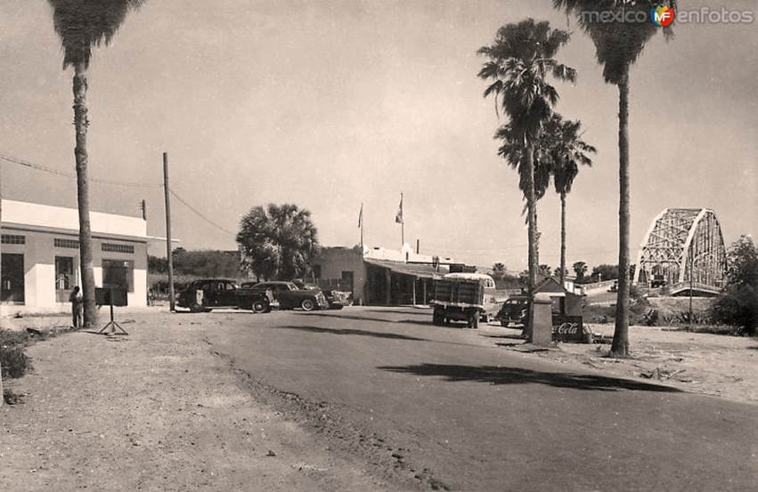 If we had crossed the border here in the 1940s, the northbound route would have appeared similar to this with a winding, palm-laden road leading to the Gateway International Bridge. [6] 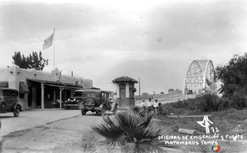 [7] 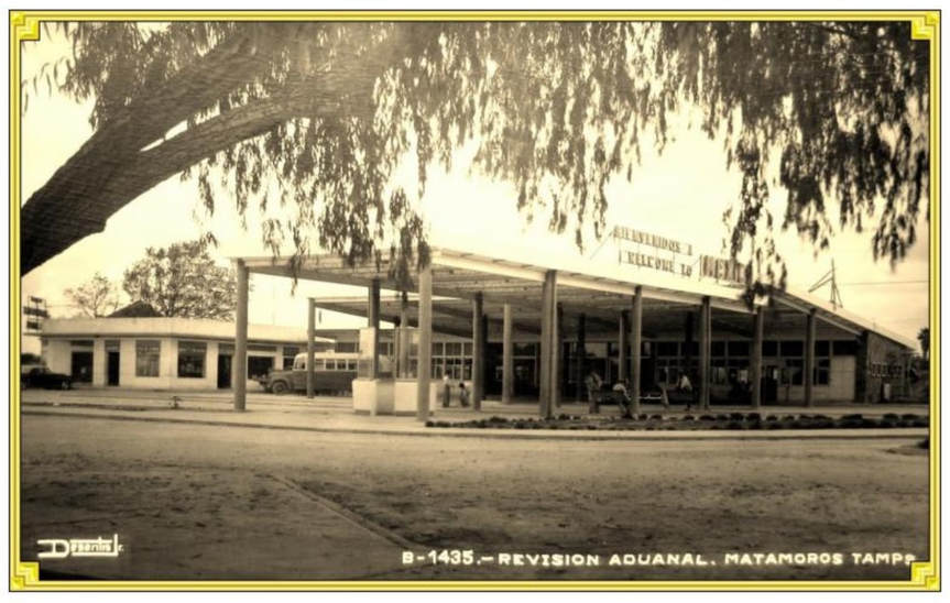 Nevertheless, in 1949 the port of entry from the previous image was demolished to make way for a more modern inspection station. While the 1928-1949 customs building had a picturesque charm with its quaint adobe appearance, the 1950-1962 aduana looked more like a large gas station. [8] 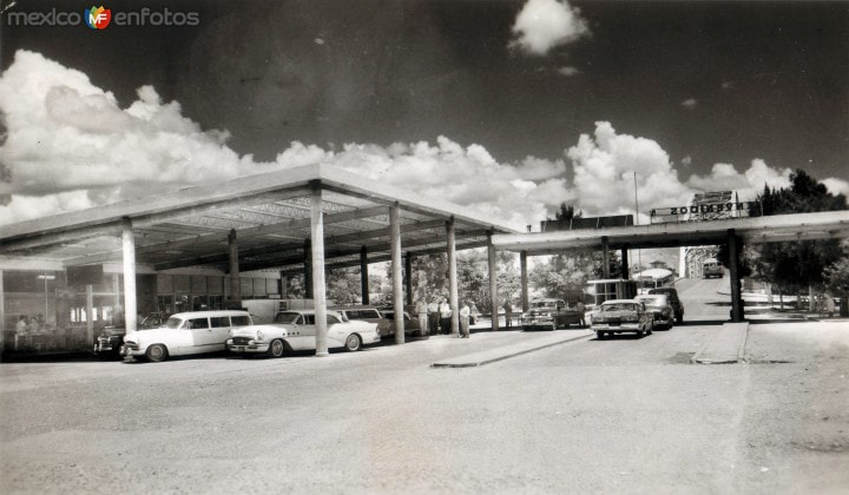 Looking north. [9] 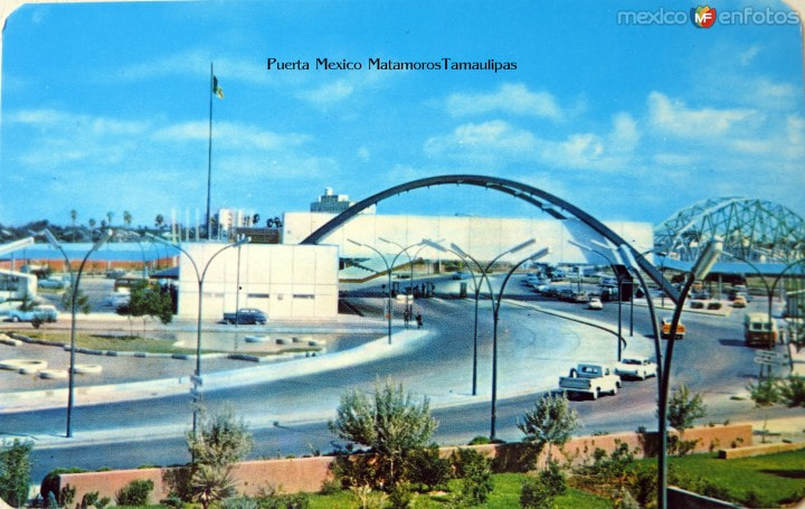 Both the Puerta México and the first Gateway International Bridge appear in this 1960s-era postcard which also looks northward. [10] 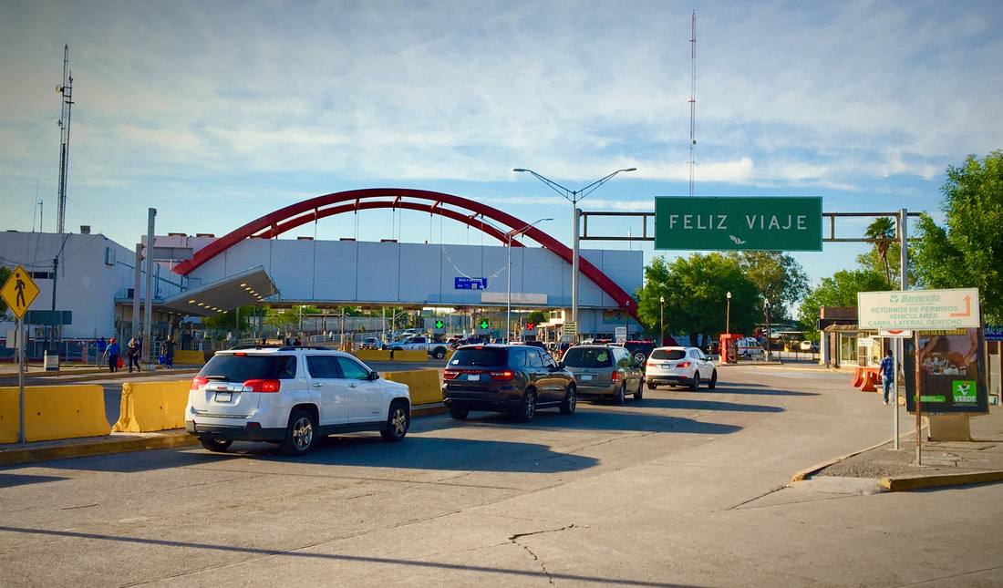 Today motorists typically wait a significant amount of time to cross into the U.S. via the northbound automobile lanes. 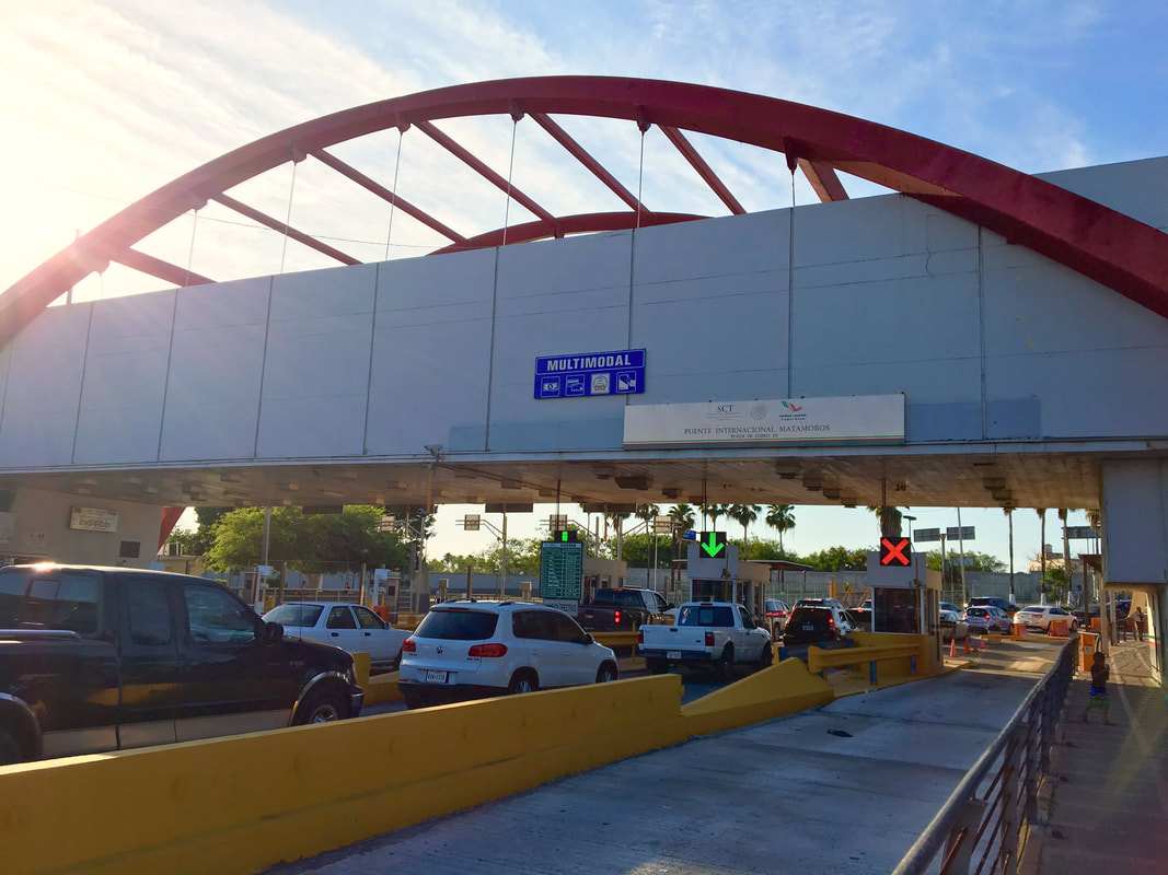 The only reminder here of the existence of the historic Santa Cruz Port of Entry and ferry crossing is the toll booth where motorists and pedestrians pay their bridge tolls before crossing over the Rio Grande the way people did before embarking on cross-river ferries in the 1800s and early 1900s. 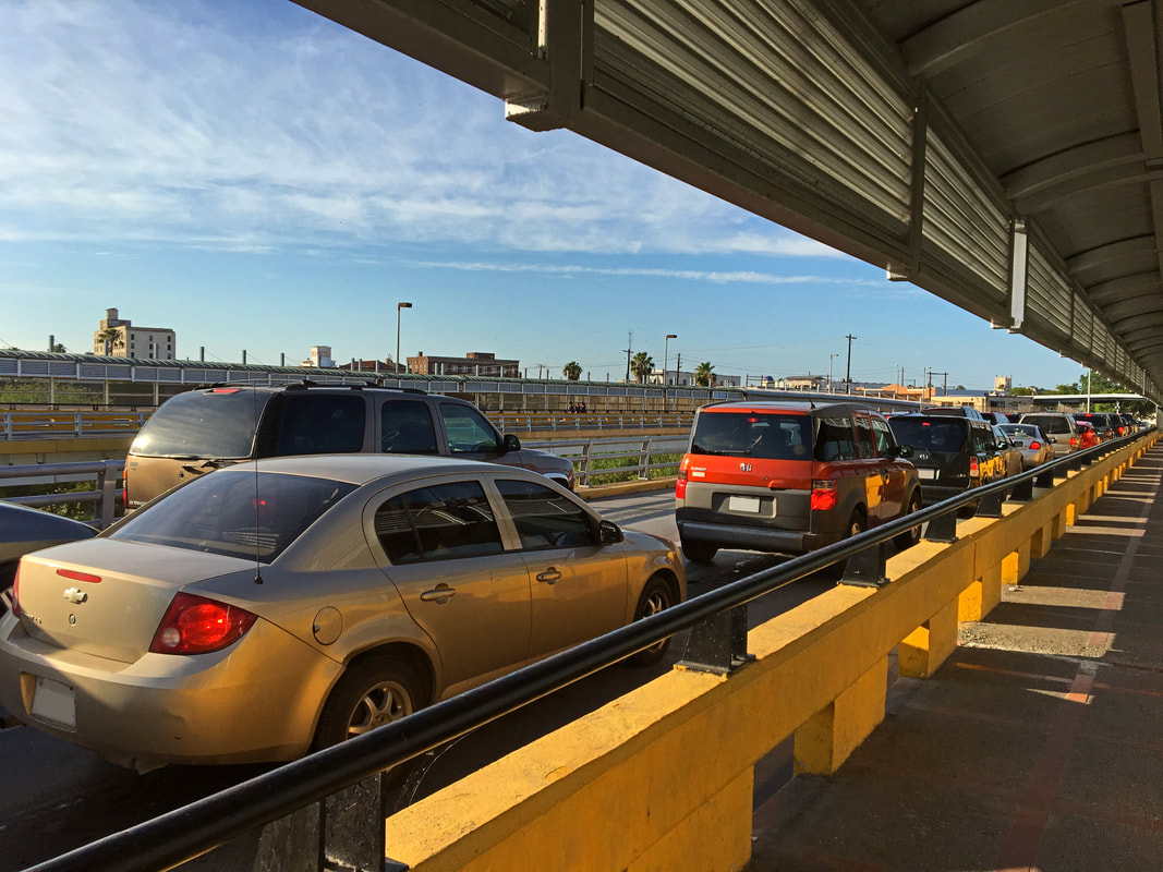 More waiting along the bridge’s northbound lanes. Our trek continues towards the U.S. Port of Entry…in our next photo essay we will explore how the Brownsville Port of Entry has changed throughout its history, from being a wooden boardwalk for ferries to its modern condition as the most crossed port of entry in far southern Texas. What can we expect of the entry into the U.S. after crossing Pani’s Puerta México? NOTES:[1] Usuario Yayozarate “La Entrada,” México En Fotos (https://www.mexicoenfotos.com/antiguas/tamaulipas/matamoros/la-entrada-MX14796711646186/1) [2] “Photo 8: Photo of Brownsville/Matamoros Bridge,” Krystal Torrez Collections, Brownsville History Harvest, University of Texas Rio Grande Valley (https://utrgv-ir.tdl.org/utrgv-ir/handle/2152.6/613) [3] Usuario Hurgres, “Aduana fronteriza (1963),” México En Fotos (https://www.mexicoenfotos.com/~hugres/aduana-fronteriza-1963-MX12182447577332/1) [4] Locatel CDMX, Twitter, February 23, 2017 (https://twitter.com/locatel_mx/status/834791964323221505) [5] Manuel Humberto González Ramos, Historia Ilustrada de la Aduana en H. Matamoros, Tam. México,”2017 (https://issuu.com/cronistadematamoros/docs/inauguracion_de_las_garitas) [6] Usuario Fotoantigua, “Matamoros, revisión aduanal,” México En Fotos (https://www.mexicoenfotos.com/antiguas/tamaulipas/matamoros/matamoros-revision-aduanal-MX14145487487213/6) [7] Usuario Centli, “Puente internacional y oficinas de migración,” México En Fotos (https://www.mexicoenfotos.com/antiguas/tamaulipas/matamoros/puente-internacional-y-oficinas-de-migracion-MX14501100970120/2) [8] González Ramos, Historia Ilustrada de la Aduana en H. Matamoros (https://issuu.com/cronistadematamoros/docs/inauguracion_de_las_garitas) [9] Usuario Centli, “Garita del Puente Nuevo,” México En Fotos (https://www.mexicoenfotos.com/antiguas/tamaulipas/matamoros/garita-del-puente-nuevo-MX13229838194048/10) [10] Usuario Yayozarate, “Puerta Mexico,” México En Fotos (https://www.mexicoenfotos.com/antiguas/tamaulipas/matamoros/puerta-mexico-MX14032163237179/8) #matamoros #tamaulipas #texas #southtexas #riogrande #riobravo #border #usmexicoborder #puertamexico #mariopani #pani #internationalbridge #bridge #puente #brownsville
0 Comments
Leave a Reply. |
Carlos Parra
U.S.-Mexican, Latino, and Border Historian Archives
January 2021
Categories
All
|
 RSS Feed