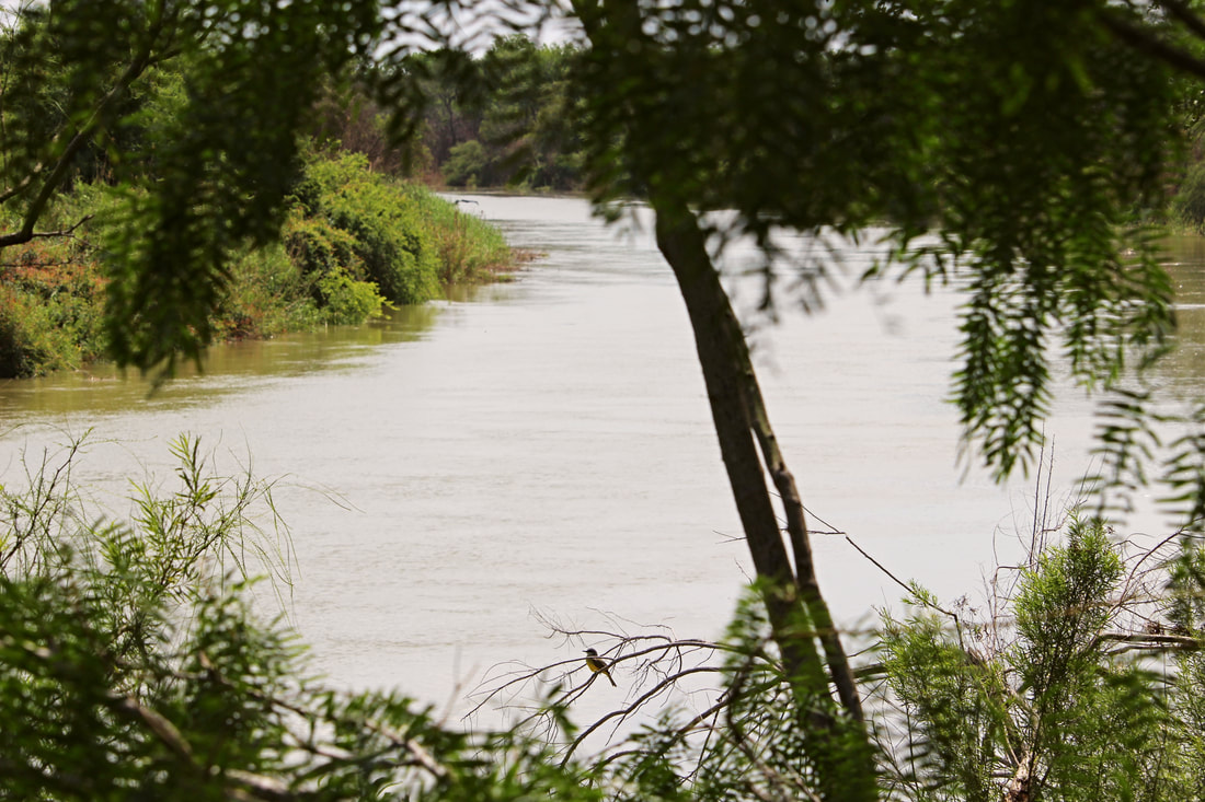
 A small bird rests on a tree along a quiet stretch of the Río Grande in South Texas/Tamaulipas. The border river has a great emotional presence in both the U.S. and Mexican imagination, often leading to the belief that the entire river is a dangerous haven of crime. Although the Río Grande has its human-caused dangers, its cultural and natural history is much, much deeper than what is often presented in the news. Currently much of this quiet riverine forest is in danger of being destroyed by the U.S.’s border wall project. In a coming Nomadic Border photo essay, we will explore some of this rich history at the peaceful riverside Santa Ana National Wildlife Refuge in Texas.
1 Comment
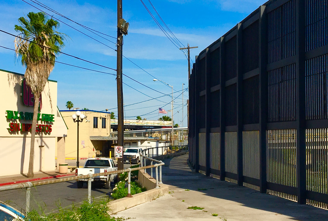 The Brownsville Gateway Port of Entry as seen from a nearby alley. The fence in this image serves to block access to the Texan bordertown from the edge of the Rio Grande (Rio Bravo). We have explored the Gateway International Bridge (AKA the “New Bridge”) and the iconic Puerta México into Matamoros and now we will explore the main U.S. port of entry into Brownsville: the Gateway Port of Entry. Situated north of the Gateway Bridge (symbolic for demonstrating the transborder ties between the U.S. and Mexico), the Brownsville Gateway Port of Entry could also be considered symbolic due to its long history. If the Puerta México welcomes us to northeastern Mexico, is the Gateway Port of Entry similarly welcoming into South Texas? 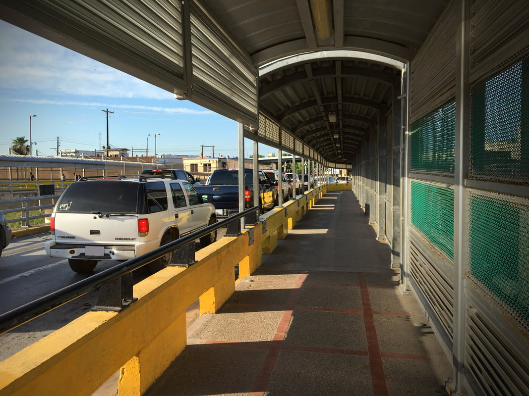 This vehicular and pedestrian crossing along the Gateway Bridge is the busiest border crossing between the sister communities of Brownsville and Matamoros. The international border is seen in the center of the image (note how the sidewalk surface changes, marking the dividing point between Mexico and the U.S.) 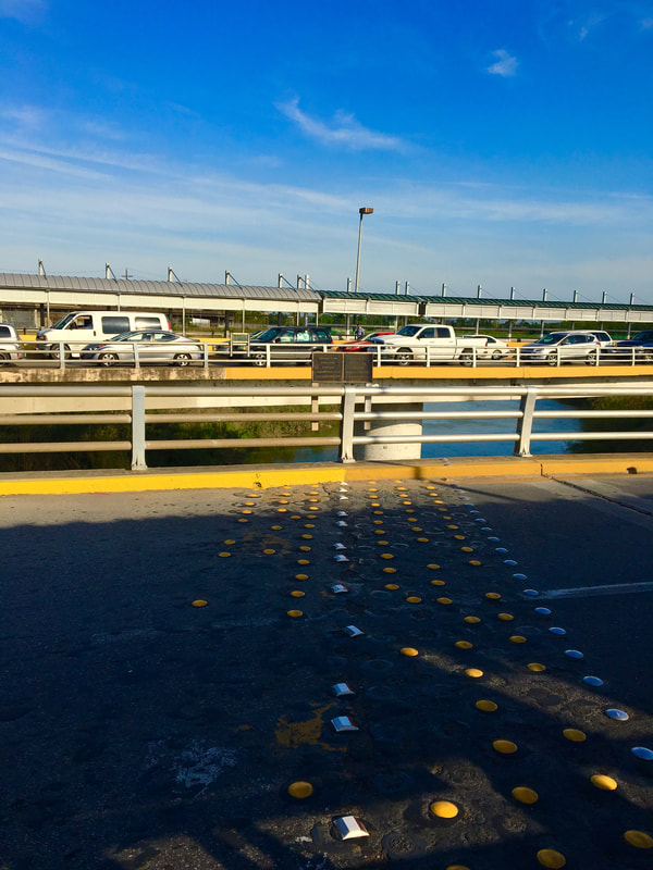 Situated just 25 miles (40km) from the mouth of the Rio Grande (Rio Bravo del Norte) on the Gulf of Mexico, the binational cities of Matamoros and Brownsville anchor the extreme east of the Mexico-U.S. international border. Brownsville – on the southernmost tip of Texas – and Matamoros – itself near the extreme northeast point of Mexico in the state of Tamaulipas – form a classic example of a cross-border sister city community, although in recent years the rise of narco violence on the Mexican side and the U.S. government’s desires to build more border walls in this area have gotten more attention than the rich bicultural histories of these cities. Today we will better appreciate some of this historical heritage by exploring a common, but extremely significant symbol in the Mexico-Texas border region: the symbol of the international bridge. In crossing the Gateway International Bridge (or Puente Nuevo/New Bridge) between Matamoros and Brownsville we will dust off the cob webs of another chapter in the cross-border history of Mexico and the United States. 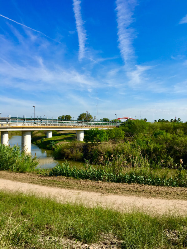  Previously when commemorating the 170th anniversary of the signing of the Treaty of Guadalupe Hidalgo we journeyed to the far western corner of the new border that the peace agreement between the U.S. and Mexico created. Surrounded by hills and beach-going crowds on the Mexican side, Boundary Monument 258 marks the U.S.-Mexico border between the corners of Tijuana and San Diego. At 258, it is the highest numbered boundary marker along the land portion of the U.S.-Mexico border which begins with Boundary Monument 1, located 700 miles to the east just outside of Ciudad Juárez-El Paso. Unlike the busy, tightly-controlled scene at Playas de Tijuana/Friendship Park, Boundary Monument 1 is in a hidden canyon along the Rio Grande and without major fence barriers. If, as some border artists have asserted, boundaries are scars on the Earth [1], this is where the wound across the desert begins.
|
Carlos Parra
U.S.-Mexican, Latino, and Border Historian Archives
January 2021
Categories
All
|
 RSS Feed