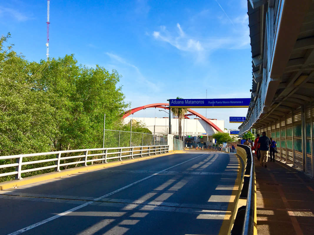
 Situated just 25 miles (40km) from the mouth of the Rio Grande (Rio Bravo del Norte) on the Gulf of Mexico, the binational cities of Matamoros and Brownsville anchor the extreme east of the Mexico-U.S. international border. Brownsville – on the southernmost tip of Texas – and Matamoros – itself near the extreme northeast point of Mexico in the state of Tamaulipas – form a classic example of a cross-border sister city community, although in recent years the rise of narco violence on the Mexican side and the U.S. government’s desires to build more border walls in this area have gotten more attention than the rich bicultural histories of these cities. Today we will better appreciate some of this historical heritage by exploring a common, but extremely significant symbol in the Mexico-Texas border region: the symbol of the international bridge. In crossing the Gateway International Bridge (or Puente Nuevo/New Bridge) between Matamoros and Brownsville we will dust off the cob webs of another chapter in the cross-border history of Mexico and the United States. 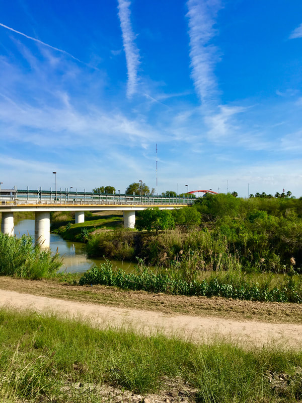 Crossing the new international border on the Rio Grande The long Mexico-U.S. border is defined in great part by the famous Rio Grande which has marked the international boundary since the 1848 Treaty of Guadalupe Hidalgo redrew the two countries’ borders. As a consequence of the U.S. invasion of Mexico between 1846-1848 the border was moved southward from the Rocky Mountains and the Great Plains to the Rio Grande. The strategic community of Matamoros (founded originally in 1774 as San Juan de los Esteros) remained in Mexican national territory due to it being located south of the river (while the former northern portion of the state of Tamaulipas was incorporated into Texas and the U.S.). Even though it has been almost completely forgotten on both sides of the border, it is important to note that the first customs house along the new U.S.-Mexico border (after 1848) was founded in 1854 just outside of Matamoros in the village of Santa Cruz – an area which is now the Puerta Mexico on the Mexican side of the Gateway Bridge. [1] 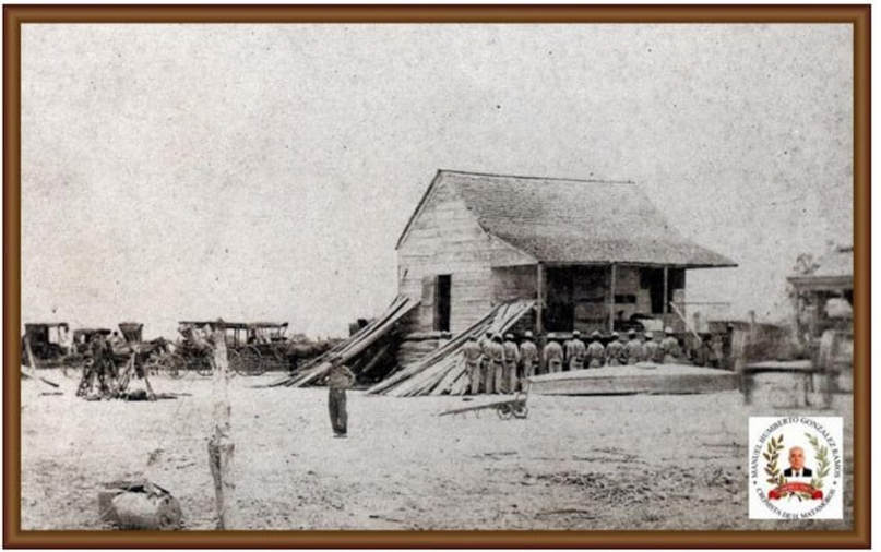 [2] On February 4, 1854, the Matamoros city council decreed the official establishment of the Santa Cruz customs house (alternatively called a “garita” or “aduana” in Spanish): “The Santa Cruz and Fortín Paredes Port of Entry is established as a crossing of the river in this city and its jurisdiction as well as the crossings of Longoreño, Burrita y Boca del Tahuachal, Vado el Capote and Vado La Palma Grande.” The first official port of entry along the two countries’ new border was just a straw house at first but by 1860 the customs house was a wood building (above). [3] 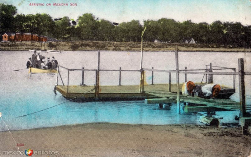 In this early 20th century postcard we can see how the Rio Grande was originally crossed on ferry boats bound for the Santa Cruz Port of Entry. [4] 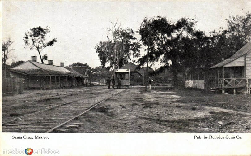 After crossing the river, local people and travelers could continue from the customs house towards the center of Matamoros 1.5 miles (3km) away via a mule-driven trolley which appears in this image. [5] 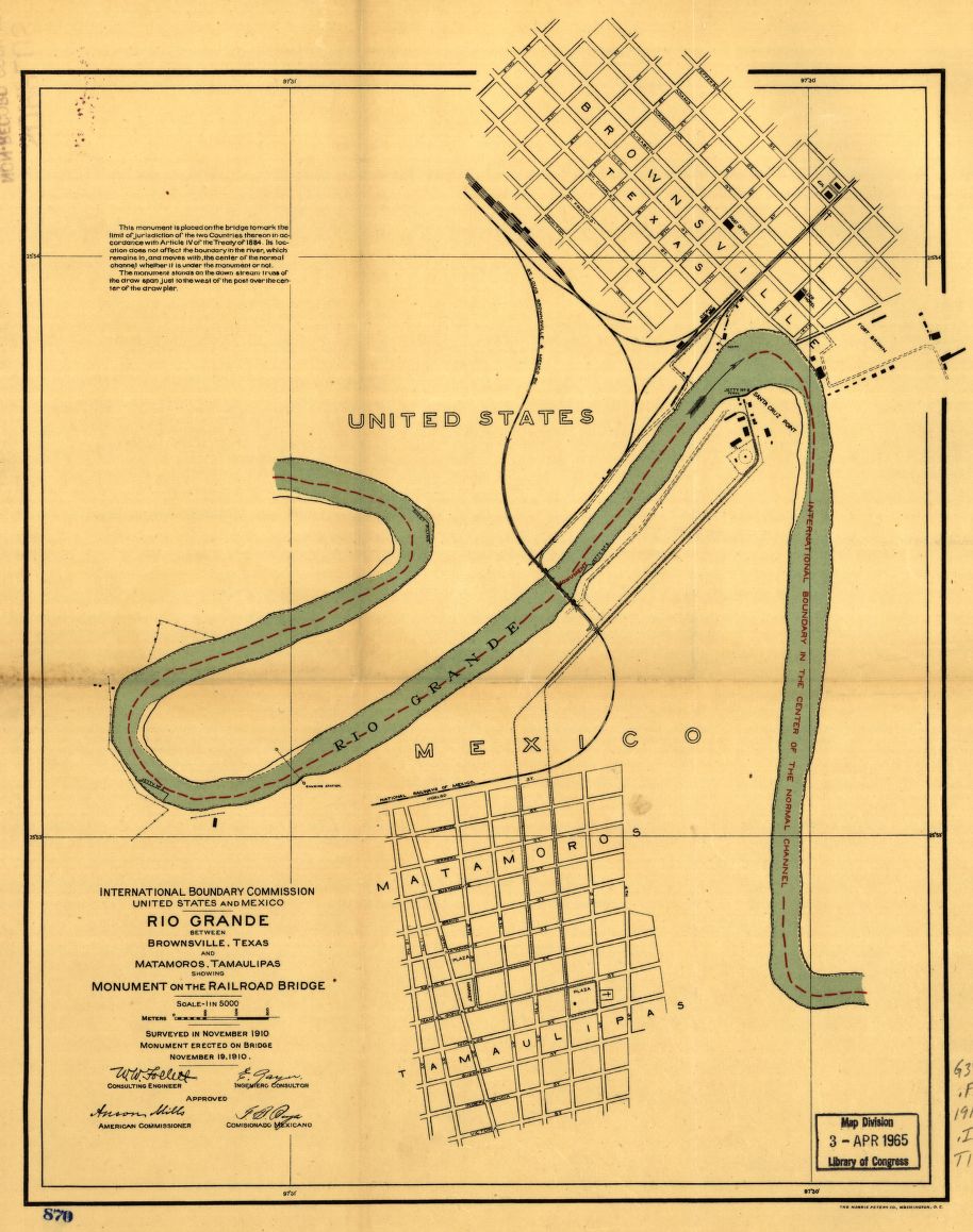 In this International Boundary and Water Commission (IBWC) map the locations of the Santa Cruz port of entry and mule-trolley route can be seen. IBWC engineers published this map to indicate the construction of a railroad bridge between the two cities known as the Brownsville and Matamoros Bridge. This bridge, the first between the two cities, is colloquially known as the “old bridge” or “puente viejo.” 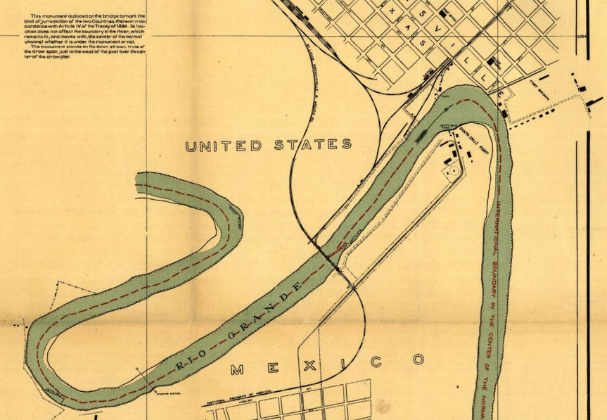 The Santa Cruz port of entry between Matamoros and Brownsville comes into focus as the strip of land sharply jutting northward in the right of the image. [6] Courtesy U.S. Library of Congress. 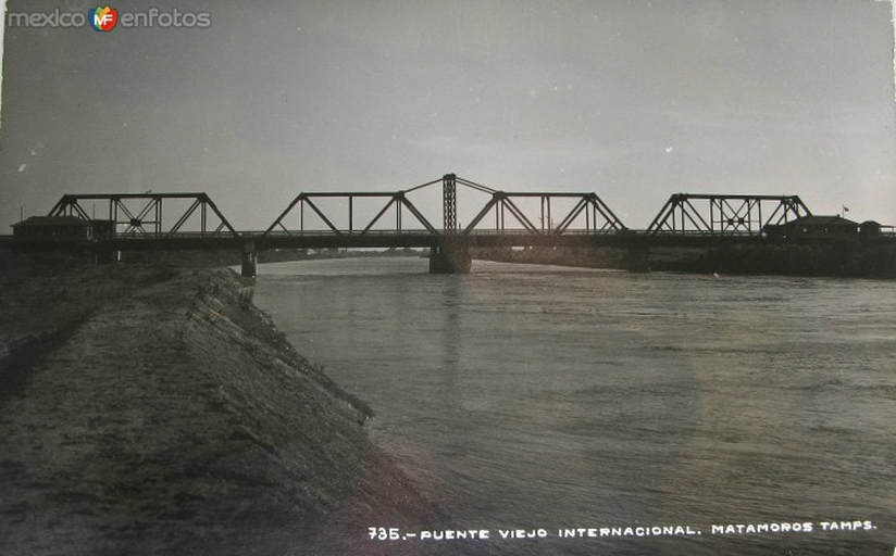 The Brownsville and Matamoros (or old) Bridge, inaugurated December 12, 1910. This bridge remains in use (below). [7] 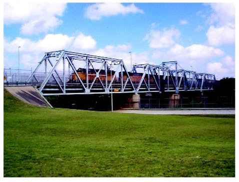 The Old New Bridge 1928-1969 Even though the “old bridge” essentially connected the two border towns, the Santa Cruz port of entry continued operating for many more years as, even with a ferry crossing, it was more direct to cross into Matamoros through there due to Santa Cruz’s proximity to downtown Brownsville. [8] However, the narrowness of the “Brownsville and Matamoros Bridge” caused many traffic problems as trains, automobiles, pedestrians and carts had to share the bridge. In 1928 both countries worked together to build a “new bridge” between the two communities. 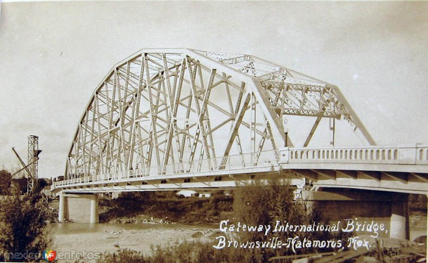 Construction of the “Gateway International Bridge” (or “Puente Internacional Matamoros”) led to the demolition of the historic Santa Cruz port of entry and the definitive end of ferry service on this portion of the Rio Grande. The “new bridge” (or “puente nuevo”) – as the crossing is still popularly known – was dedicated on July 4, 1928 and led to the urban development of the Santa Cruz area and its physical integration into the city of Heroica Matamoros as the Colonia Jardin neighborhood in 1945. [9]  A busy day on the “puente nuevo” in the 1940s. [10]  The access area to the Gateway International Bridge from Brownsville in May 2018. Just like in the days of the Santa Cruz port of entry’s existence, border crossers must pay a toll to cross the Rio Grande. The southbound toll booth appears in the center of the image.  The access to the Gateway International Bridge over 50 years ago – undated photograph from 1963-1969 period. [11]  Aerial view of the new U.S. and Mexican port of entry facilities in 1965. Note the absence of border fences along the U.S. edge of the river. [12] The New New Bridge (1969/1970 - Present) |
Carlos Parra
U.S.-Mexican, Latino, and Border Historian Archives
January 2021
Categories
All
|
 RSS Feed