 For many, the U.S.-Mexico border summons images of barrier walls and binational border towns set in arid desert landscapes. However, on January 2, 2019, snow blanketed the international boundary between Nogales, Arizona, USA, and Heroica Nogales, Sonora, Mexico. For a few hours the borderlands were a winter wonderland. 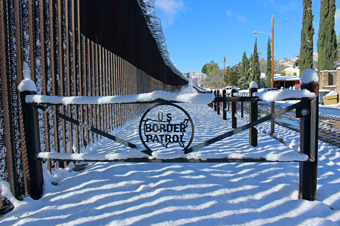 High Desert Borderlands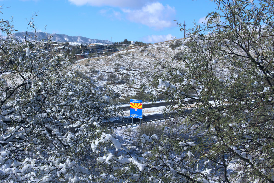 Snow surrounds an Arizona welcome sign near the terminus of Interstate 19. Although the general public’s visualization of how the Mexico-U.S. border is “supposed” to look like does not include snow, the international boundary crosses some relatively higher elevations along its trajectory. While both ends of the international boundary are at sea level at San Diego-Tijuana’s Friendship Park and the mouth of the Rio Grande near Brownsville-Matamoros, the border’s highest point has a height of approximately 6,700 feet (2,042 meters). The border’s high point is 130 miles (208km) east of Ambos Nogales at the Puerto de San Luis (or San Luis Pass) in the Sierra San Luis (the northernmost extension of the Sierra Madre Occidental) where the Mexican states of Chihuahua and Sonora and the U.S. state of New Mexico meet. [1] 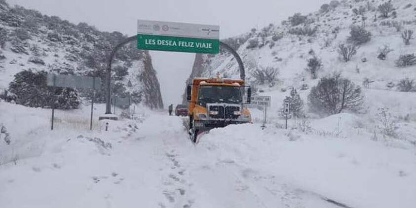 ABOVE: A few days before it snowed in Ambos Nogales, snow completely covered the Puerto de San Luis in the Sierra San Luis. Mexican Federal Highway 2 through the Puerto de San Luis is one of northern Mexico's most important roadways, linking Chihuahua and Sonora across the Sierra Madre Occidental. BELOW: The Puerto de San Luis during a 2015 snow storm. [2] 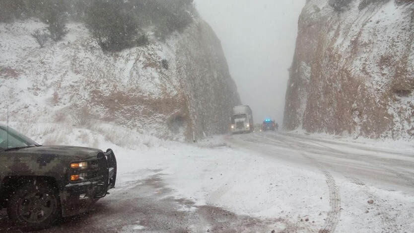
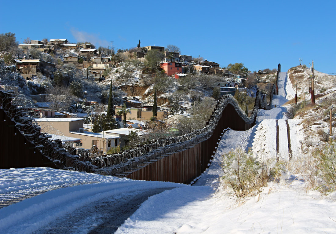
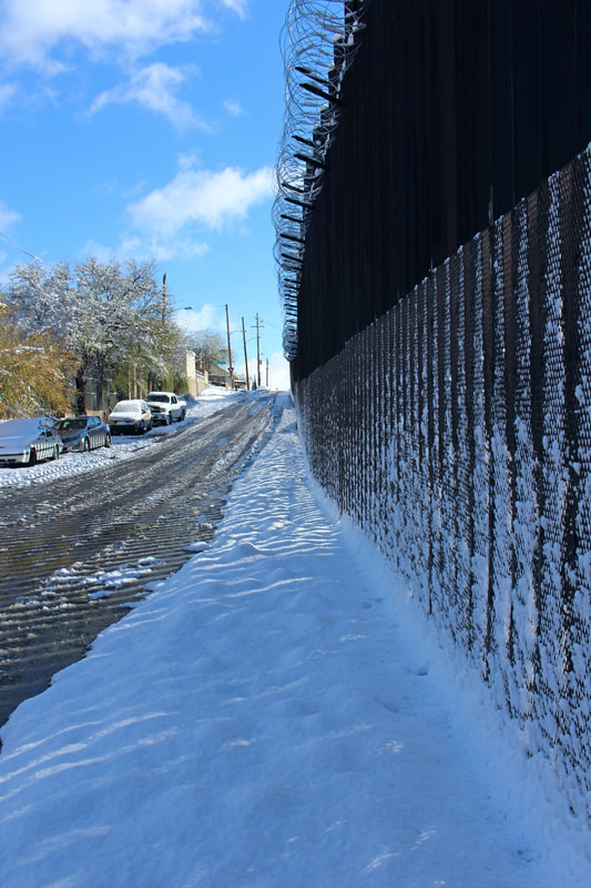
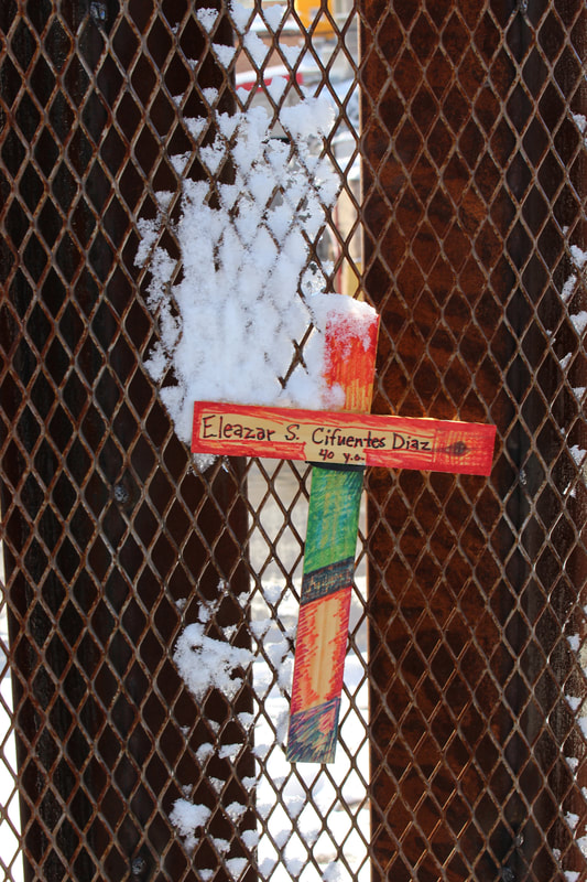
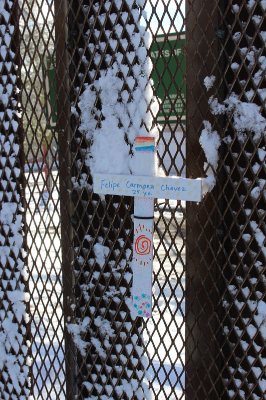
Indeed, at 3,829 feet (1,167 m) above sea level the two Nogales are the fourth-highest border towns along the U.S.-Mexico border after 4,665 foot (1,422 m) elevation Antelope Wells, New Mexico/El Berrendo, Chihuahua; Naco, Arizona/Naco, Sonora (4,610 ft/1,405 m); and Agua Prieta, Sonora/Douglas, Arizona (4,000 ft/1,129 m) at the base of the Sierra San Luis. Part of the Sonoran Desert’s highlands, Ambos Nogales experience hot summers, but also face cold winters which can bring in levels of snowfall. Severe cold fronts are dangerous for Sonora's economically marginalized communities. "Snowgales"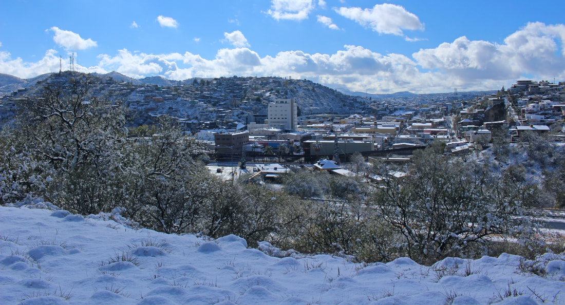 A view of downtown “Snowgales” with the border fence in the middle of the image. 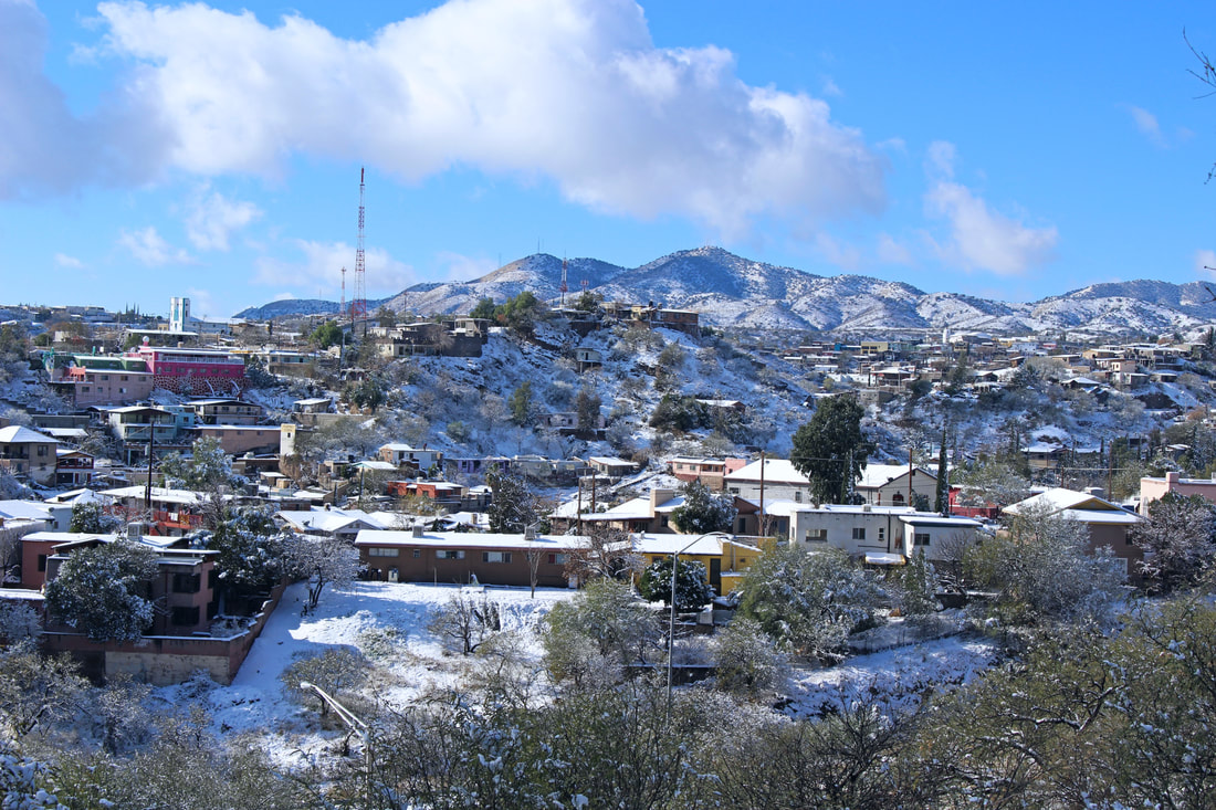 Housing atop the two Nogales’s rolling hills. The homes in the foreground are in Arizona, while the ones in the hills beyond are in Sonora. The Pajarito Mountains are in the distance. 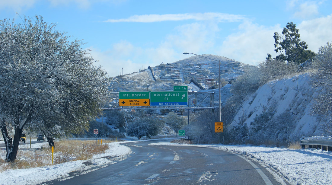 Snow transforms the normally dusty border hills of Ambos Nogales as seen from the I-19 south exit for International Street. 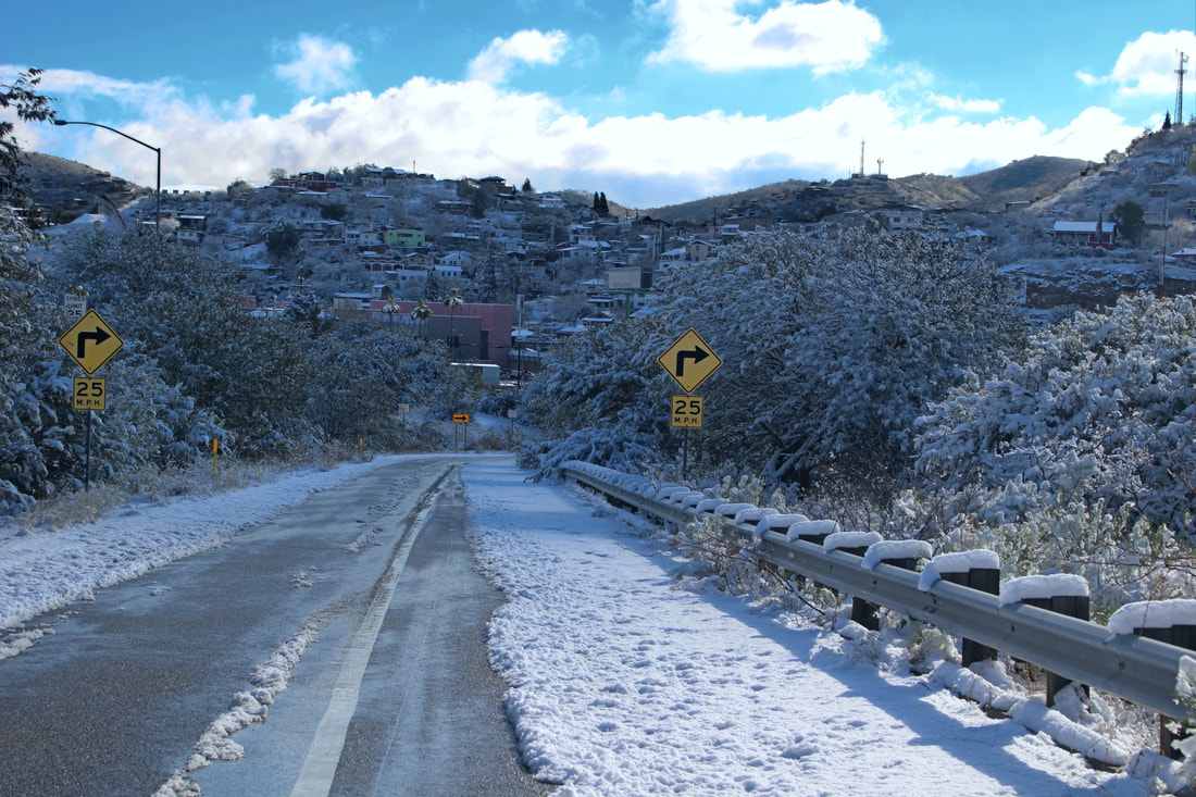 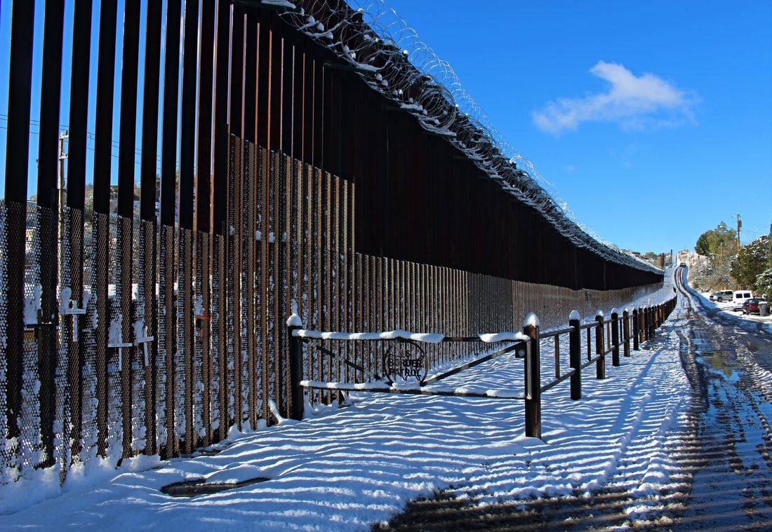 The snow-covered U.S.-Mexico border fence on West International Street in Nogales, Arizona. The current barrier was built in May-June 2011. 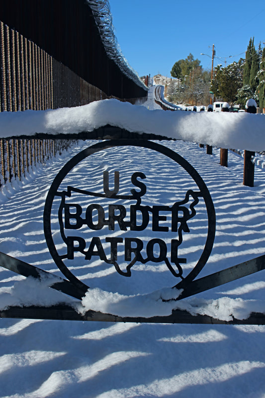 A close-up of the US Border Patrol’s welded logo on the the side of the border wall. 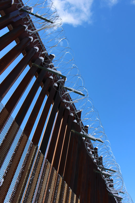 Barbed concertina wire was added to the border fence in late 2018 when fears of Central American refugees and other Latin American migrants grew in the U.S. 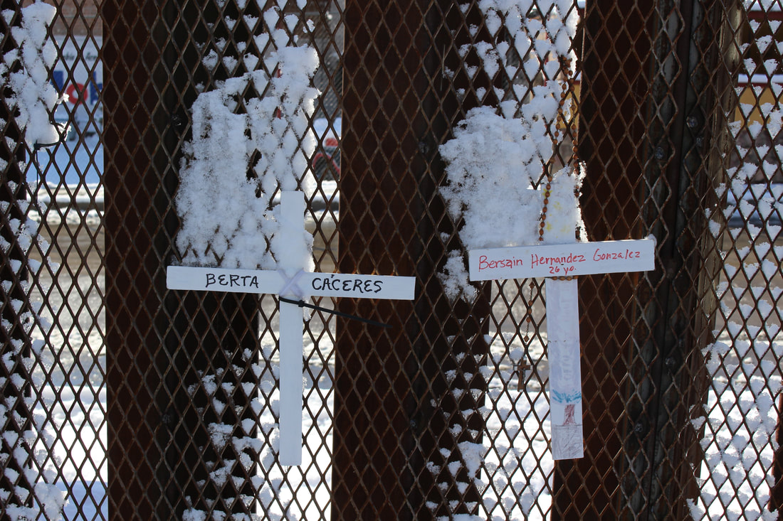 Crosses tied to the border wall mesh memorialize individuals who have died crossing the border or in political activism, such as Honduran environmental and indigenous rights leader Berta Cáceres who was killed in Honduras by developers with ties to that country’s pro-U.S. dictatorship. [3]
 The mesh seen at the bottom half of the barrier prevents people on either side of the line from exchanging objects or getting into physical contact across the border wall. 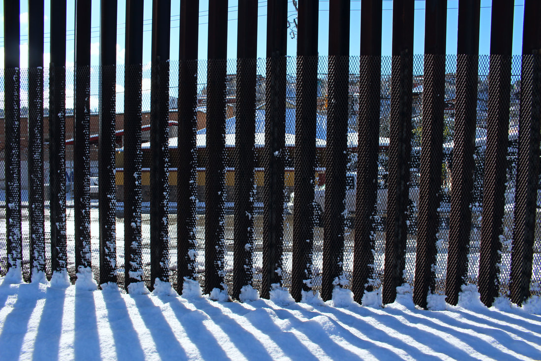 Snowy Heroica Nogales, Sonora, as seen from across the border wall. 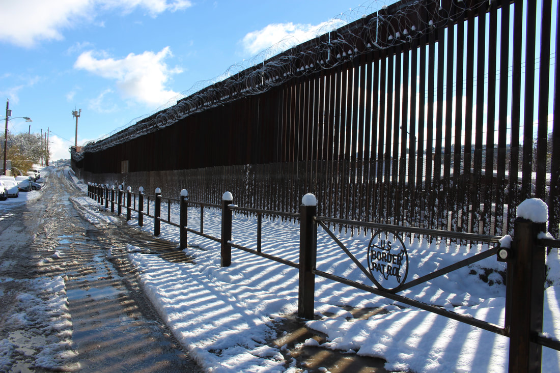 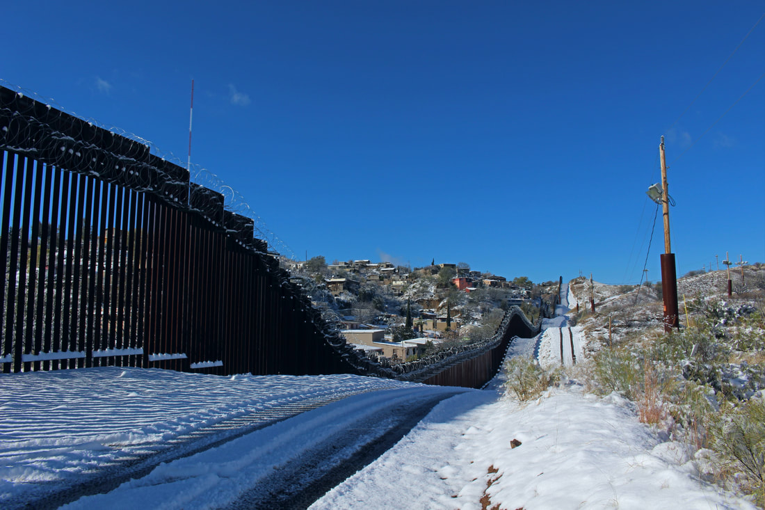 Further west after the pavement on International Street ends, we can see tracks left behind in the snow by a USBP vehicle. 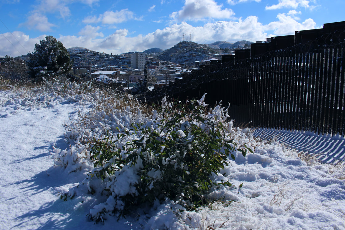 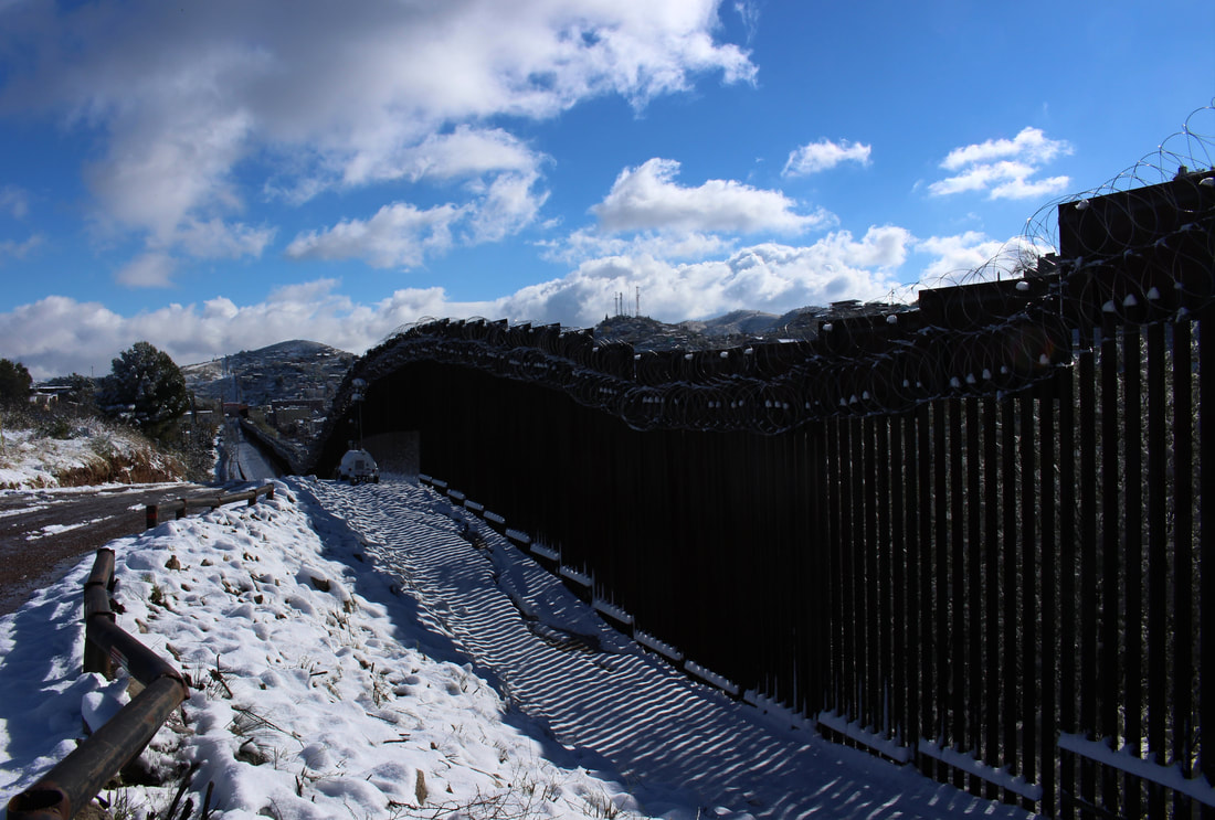 The border wall follows the rolling Nogales hillsides across the snow. Portable stadium lights help USBP agents to monitor the fence at night. 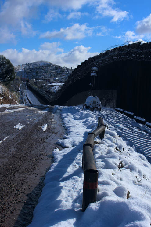 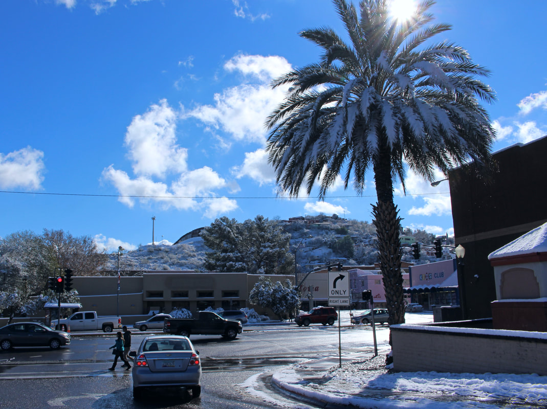 Though at an elevation of about 3,800 feet, palm trees still grow in high desert Ambos Nogales. Shoppers walk near a snowy palm tree on Grand Avenue in downtown Nogales, AZ. 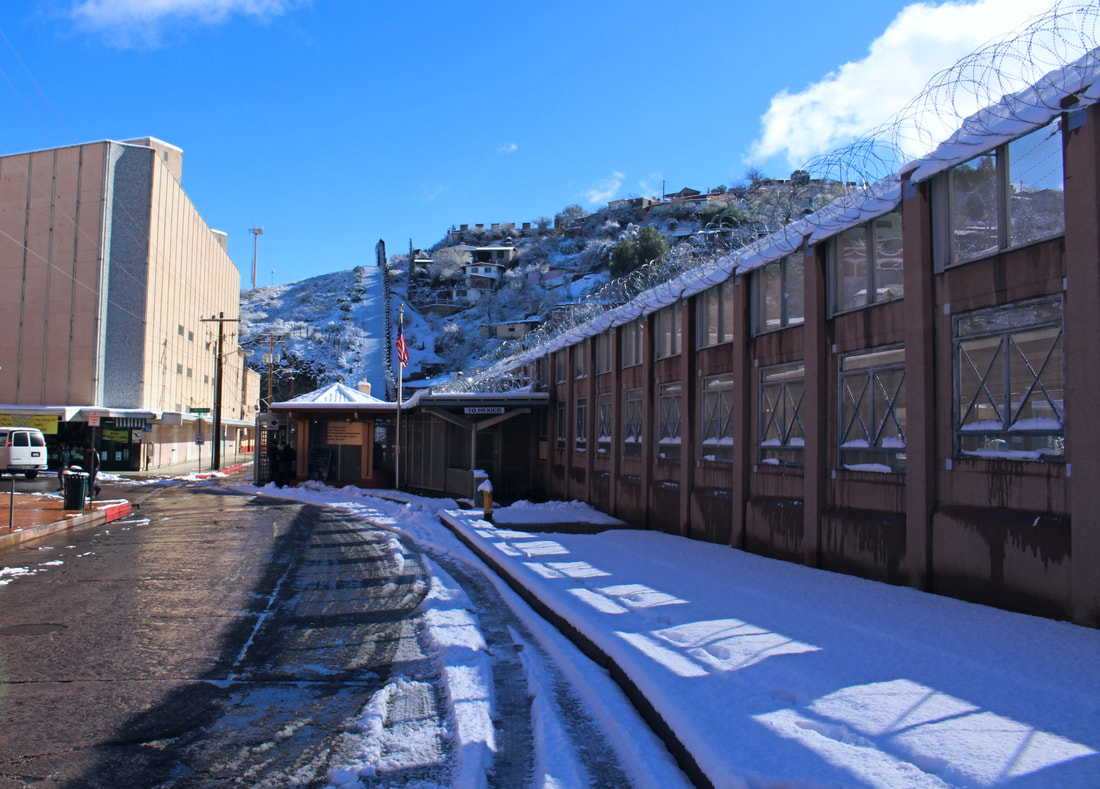 The decorative mid-1990s border wall leaves its shadow on the snow near the Morley Avenue Port of Entry in a wintery scene that might better evoke the Canada-U.S. border rather than the Mexico-U.S. border. 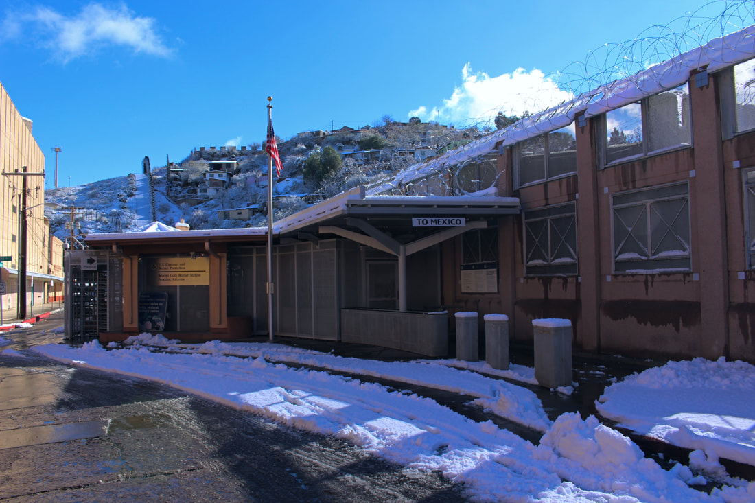 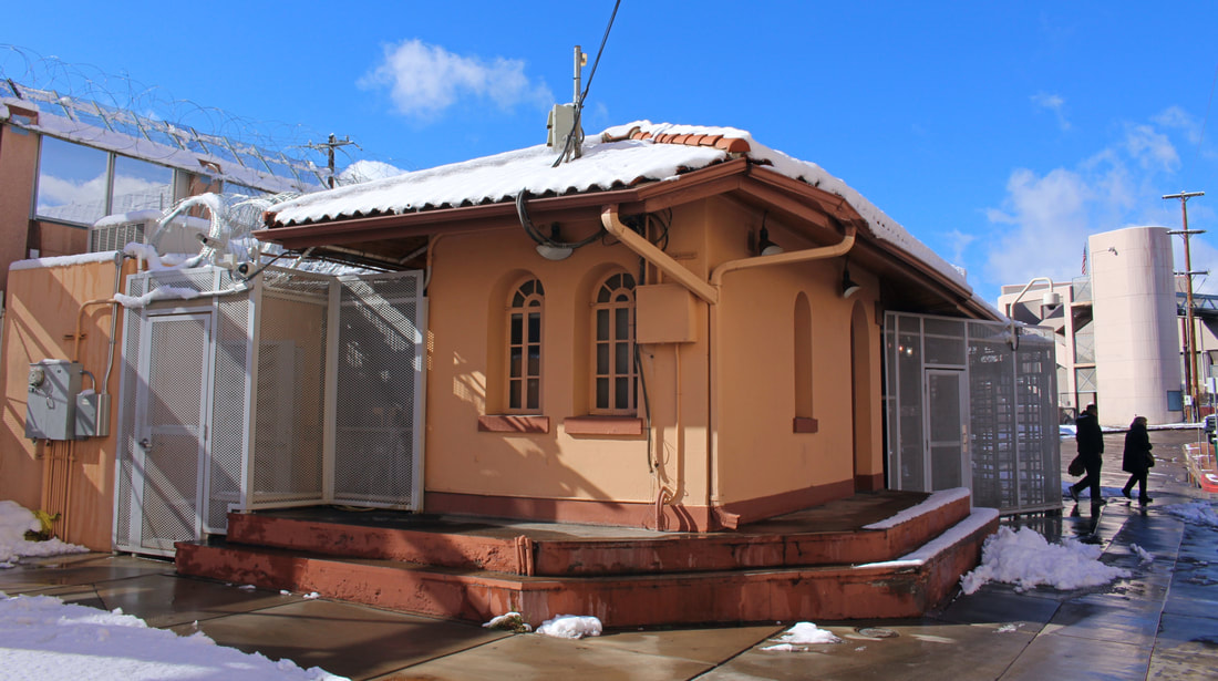 Built in the Spanish Colonial Revival style of architecture, the Morley Avenue Port of Entry first opened in 1930 and is typical of other U.S. border inspection buildings built at the time. [4] 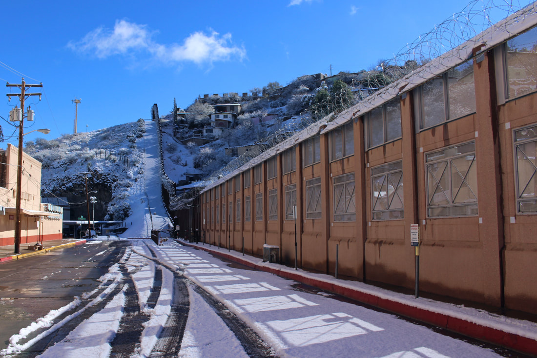 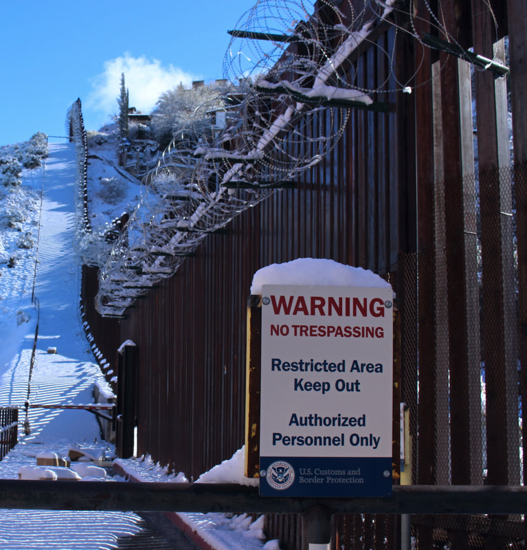 “Warning – No Trespassing.” Prior to recent years the area behind this sign was a parking lot for shoppers visiting nearby stores in either country. 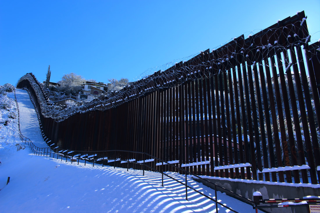 The pristine snow along this hill would almost look like a ski slope were it not for the menacing fence and newly-installed barbed wire above. 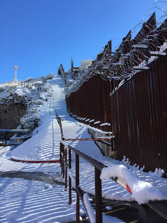 A small stream of snowmelt crosses north across the border fence at the bottom of this “ski slope.” 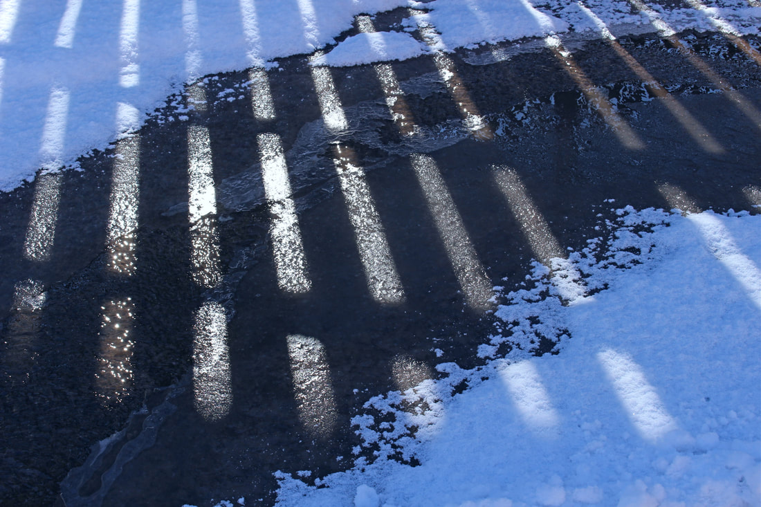 Like a great deal of the natural forces around the existing border barrier, this snowmelt quietly flows north despite the U.S. government’s efforts to control all physical access between the two countries. 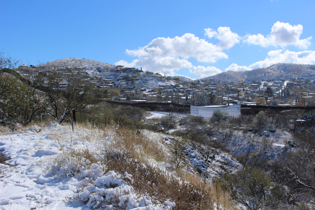 Heroica Nogales’s Colonia Buenos Aires is a densely-populated area of the city that contrasts with the sparsely-located homes on this part of Nogales, Arizona. The white-painted portion of the wall is another place where water from Mexico flows north into the U.S.  Rain (and snow!) that accumulate on the Mexican side drain northwards due to the lower elevations of the Arizona border city. The 2011 border fence here was designed to continue allowing water to drain along seasonal arroyos or washes. 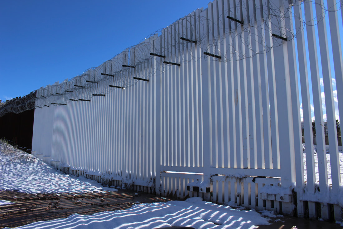
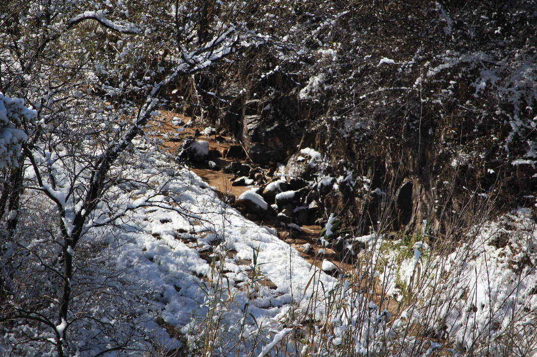 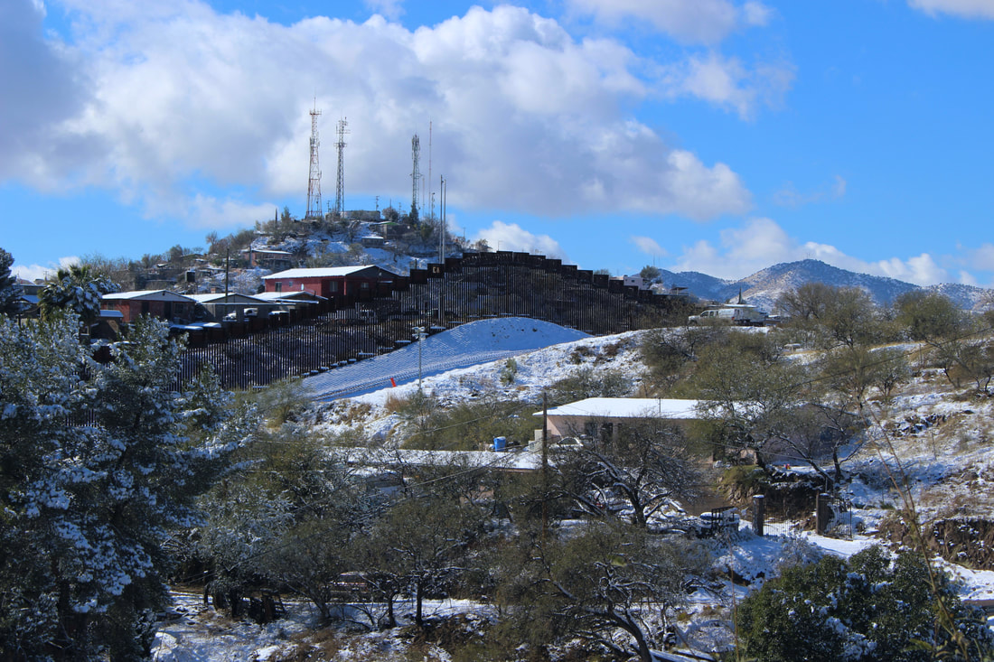 A lone USBP vehicle keeps guard along the snowy border fence near the antennas of Cerro Pelón on the Mexican side of the line. 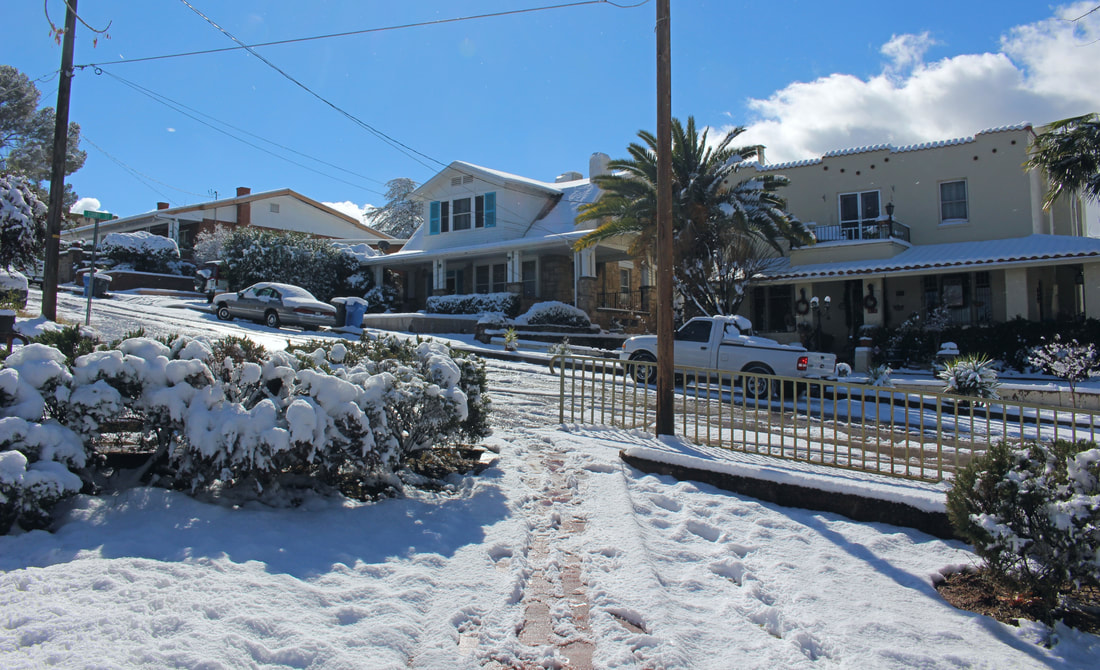 Despite all of the commotion of the border in our collective imagination, it is important to remember that Nogales is also an overwhelmingly safe community as seen in this quiet border-adjacent neighborhood along Ione Marcus Gordon Memorial Park. 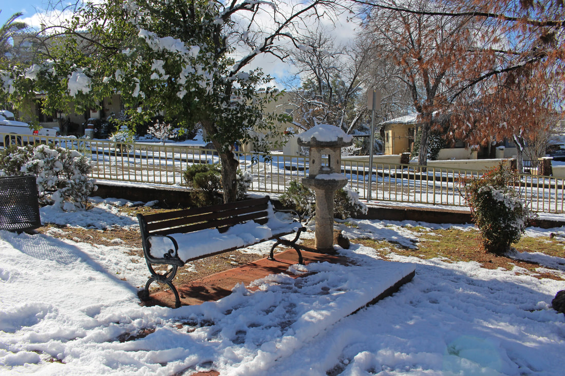 Before we melt away...Snow has become rarer in Ambos Nogales in recent years, but the January 2, 2019 snowfall is a reminder of the area’s varied high desert climate. Though the social imagination of people on either side of the fence tends to visualize the border as only a scorching hot desert setting, snowfall along higher elevations along the international boundary accentuates how much more colorful the Mexico-U.S. borderlands are on a geographic and climatological level. 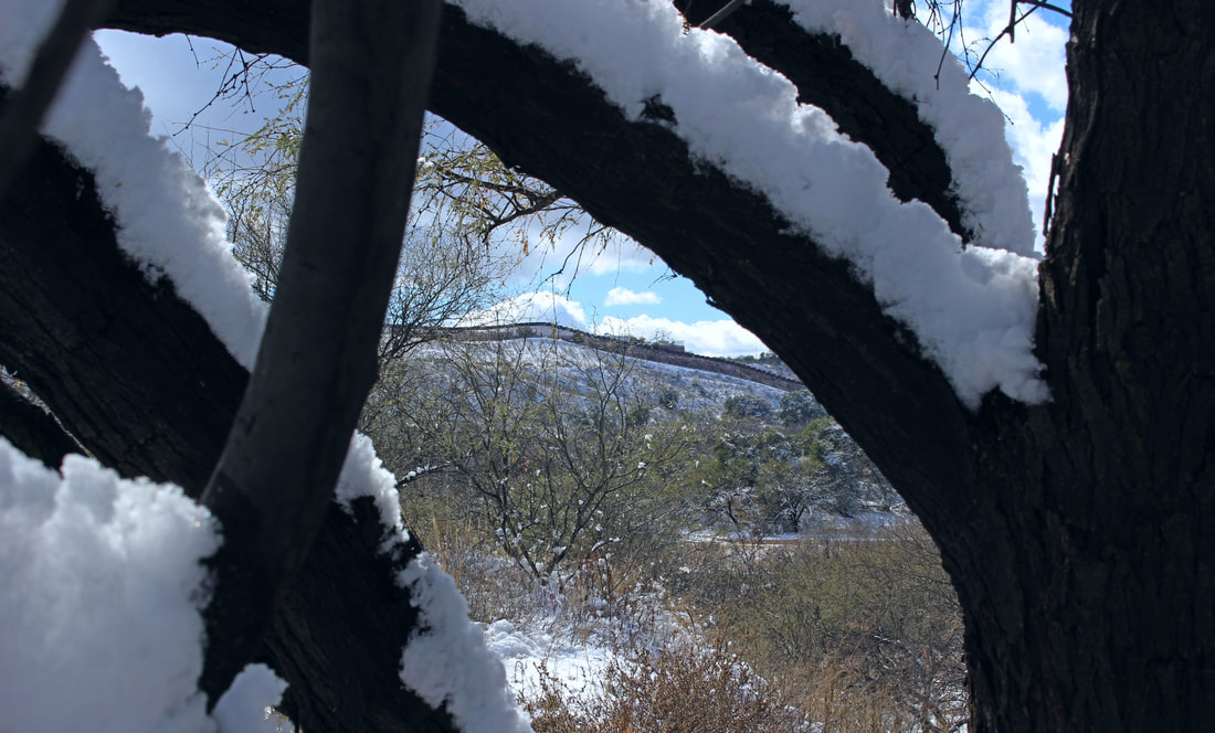 NOTES:[1] “The National Map,” (Coordinates: 31.33259/-108.75660), U.S. Geological Survey, (https://viewer.nationalmap.gov/advanced-viewer/); “Carta Topografica Agua Prieta,” Mapas, Instituto Nacional de Estadística y Geografía (https://www.inegi.org.mx/app/mapas/).
[2] Photo by Daniela Batista, “Presenta tráfico ligero carretera Janos a Puerto San Luis,” El Puntero (Dec. 30 2015), (http://elpuntero.com.mx/n/7464); “Se abre circulación en Puerto San Luis carretera Agua Prieta-Janos,” No Pasa Nada (Dec. 30, 2018), (https://nopasanada.mx/2018/12/se-abre-circulacion-en-puerto-san-luis-carretera-agua-prieta-janos/). [3] Nina Lakhani, “Berta Cáceres: seven men convicted of murdering Honduran environmentalist,” The Guardian, (Nov. 29, 2018), (https://www.theguardian.com/world/2018/nov/29/berta-caceres-seven-men-convicted-conspiracy-murder-honduras). [4] “Morley Avenue Border Inspection Station,” National Register of Historic Place, National Park Service (https://www.nps.gov/nr/feature/places/14000244.htm). [5] The Santa Cruz River is a tributary of the Gila River to which it drains its water (mostly underground at that point) west of downtown Phoenix. The Gila River then flows west towards the Colorado River in Yuma which then drains into Mexico’s Gulf of California. See “The Vanishing Santa Cruz River,” National Park Service (https://www.nps.gov/articles/vanishingsantacruzr.htm); and Robert H. Webb, Julio L. Betancourt, R. Roy Johnson, R. M. Turner, and Bernard L. Fontana, Requiem for the Santa Cruz: An Environmental History of an Arizona River (Tucson: University of Arizona Press, 2014). #Nogales #AmbosNogales #Arizona #Sonora #USMexicoBorder #Borderlands #Geography #Climate #SonoranDesert #ChihuahuanDesert #Snow #Snowgales #Winter #LaFrontera #MorleyAvenue #MorleyAvenuePortofEntry #DesertSnow #HighDesert
0 Comments
Leave a Reply. |
Carlos Parra
U.S.-Mexican, Latino, and Border Historian Archives
January 2021
Categories
All
|
 RSS Feed