NOMADIC BORDER | LA FRONTERA NOMADA
  • Nomadic Border
    • Echoes from the Borderlands >
      • Battle of Ambos Nogales (Part I)
      • Battle of Ambos Nogales (Part II)
      • The Chicano Moratorium 50 Years Later
      • Monumental Border Mistakes: Boundary Monument 127
      • Mexico's Lost Archipelago >
        • Mexico's Claims to the Channel Islands
        • Brown Beret Occupation of Catalina Island
        • Catalina: Borderland at Sea
        • San Clemente Island: A "Voyage into the Heart of Darkness"?
        • San Miguel: Island of Many Kingdoms
    • Border Crossings
    • PHOTO ESSAYS
    • ABOUT ME
    • Terms of Use
  • La Frontera Nomada
    • EXPOSICIONES EN LINEA >
      • La Batalla del 27 de agosto entre los Ambos Nogales (Parte I)
      • La Batalla del 27 de agosto entre los Ambos Nogales (Parte 2)
      • El Archipielago Mexicano Perdido >
        • El Reclamo Mexicano Sobre el Archipiélago del Norte en California
      • La Moratoria Chicana a sus 50 Años
    • FOTO GALERIAS
    • ACERCA DE MI
    • Condiciones de Uso

EXTRA: Monumental Border Mistakes: Boundary Monument 127 and the Arizona-Sonora Line

1/22/2021

4 Comments

 
Picture
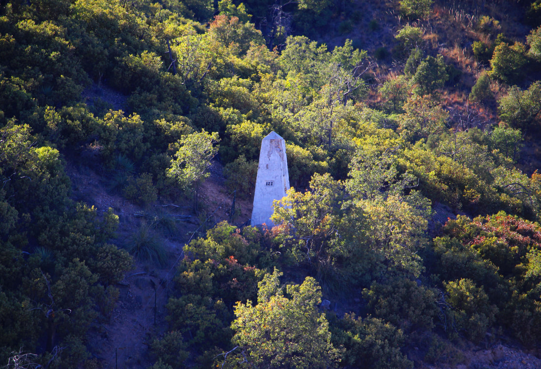
​Nestled in the rough mountainous country west of the cities of Nogales, Arizona, and Nogales, Mexico, Boundary Monument 127 is a significant geographic turning point for the U.S.-Mexican border - and is located on the WRONG spot!
​Read the full story of this 170-year-old incorrect border marking HERE after viewing these images from the historic Arizona-Sonora boundary angle along the U.S.-Mexican border west of Nogales. Please leave a comment at the end of your journey here.
Picture
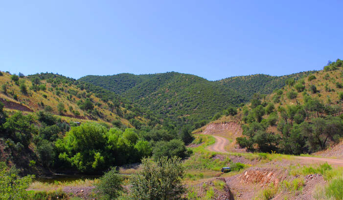
The “Boundary Angle Canyon” where U.S.-Mexico Border Monument 127 is located is accessible via Forest Service Road 222.
Picture
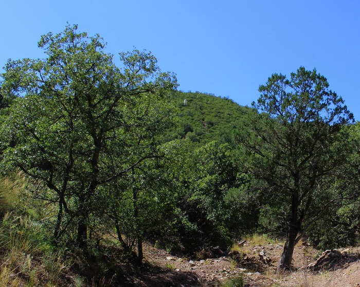
​The “Boundary Angle Arroyo” where there used to be a narrow trail to Boundary Monument 127.
Picture
Picture
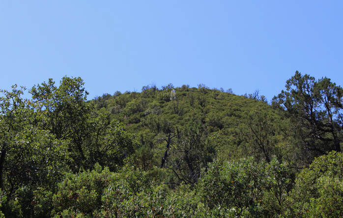
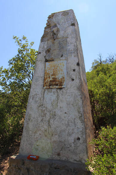
​Boundary Monument 127 has marked the Arizona-Sonora boundary angle since June 1855.
​“Boundary Angle Canyon” is a mostly remote area, but U.S. border wall system construction in summer and fall 2020 made this corner of the Pajarito Mountains a busy crossroads.
Picture
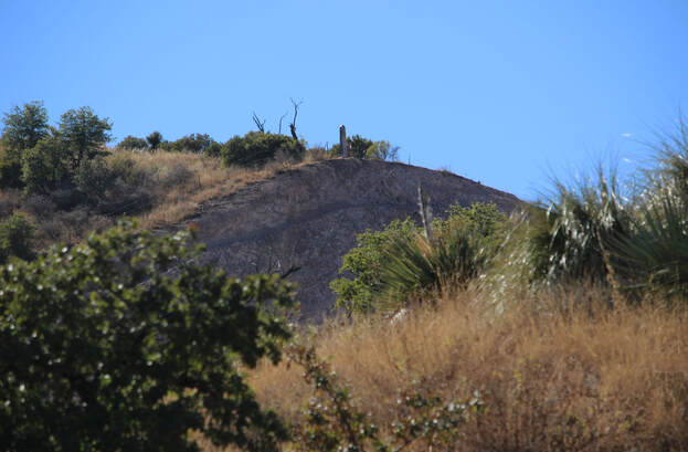
Boundary Monument 126 and its bulldozed hillside east of Monument 127.
Picture
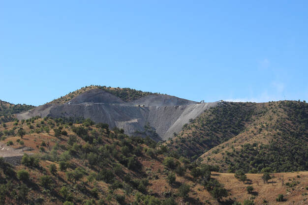
The mountainside northwest of Boundary Monument 127 has been destroyed to serve as a batch plant for preparing border wall concrete. By November 2020 Boundary Monument 128 (on the cut-out mountain to the left) became the base camp for construction work heading deeper into the rugged Pajarito Mountains.
Picture
From “Boundary Angle Canyon” the slight change in the U.S.-Mexican border is hard to see, but from a distance to the east the change in the border’s direction is made clear by the destructive border wall’s footprint.
Picture
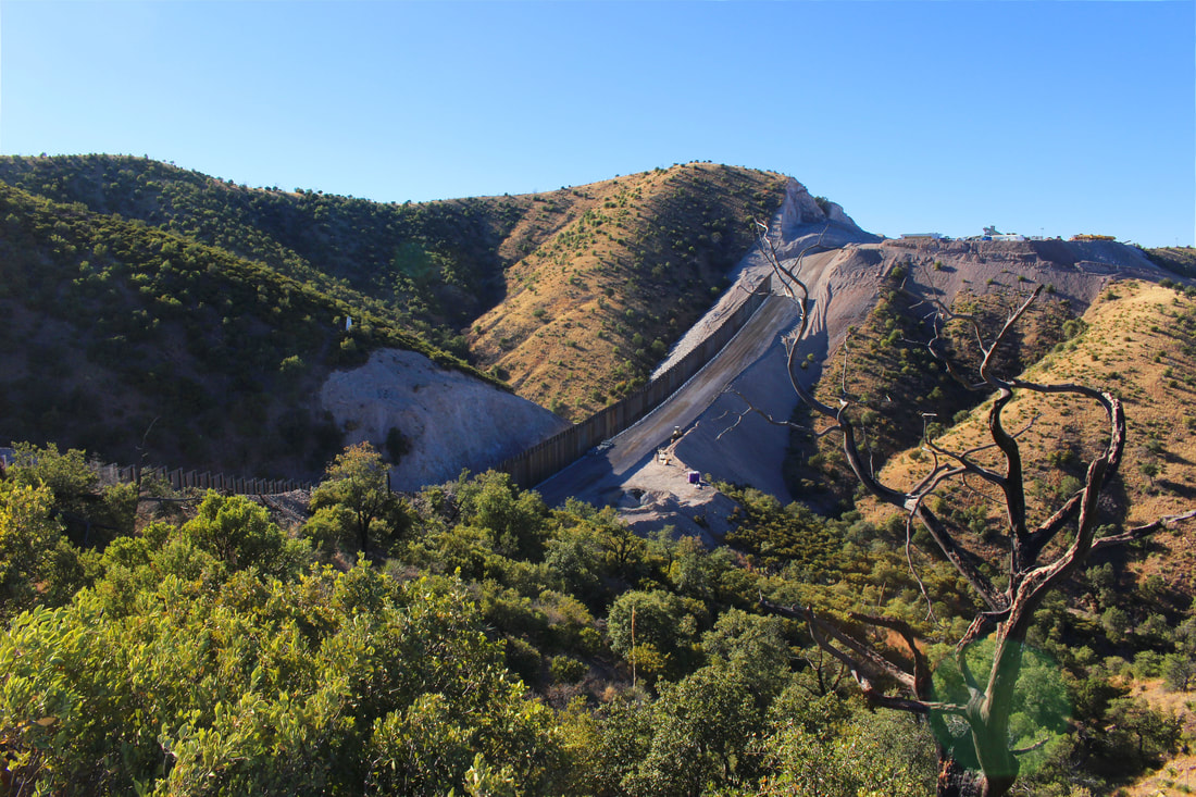
​Though located on the wrong spot for 170 years, Boundary Monument 127 still marks the angle along the Arizona-Sonora border between Nogales and the Colorado River. Will this neglected and endangered monument – which includes a handwritten inscription from the 1855 U.S. Boundary Commission – survive amid this altered landscape?
4 Comments
M.C.
1/24/2021 11:26:26

This is a very interesting article. I enjoyed reading how the mistake was made and the implications it has to this day. However, I am wondering if the author was able to do some research as to why the "new Commission did not have the power to realign the border" when they discovered this "monumental error" 40 years later in the 1890s. What, or who, exactly prevented the correction of this mistake?

Overall, very intriguing piece. Never would've thought the US-Mexico border is off. Well done, Mr. Parra, for bringing this to light.

Reply
JM
1/25/2021 15:34:57

Well-put

Reply
JM
1/25/2021 15:33:25

The marker is placed in the wrong spot??

Reply
Trish Anderson
2/9/2021 20:03:14

I really enjoyed this article. I had no idea the border was actually marked in the wrong space. It really makes one scratch their head that things like this can go unnoticed and unmentioned in history. I also really liked the history of the border and especially the photographs along the two Nogales cities. Easy to follow and full of interesting information!

Reply


Leave a Reply.

    Carlos Parra

    U.S.-Mexican, Latino, and Border Historian

    Archives

    January 2021
    August 2020
    June 2020
    January 2020
    July 2019
    May 2019
    March 2019
    January 2019
    December 2018
    September 2018
    August 2018
    July 2018
    June 2018
    May 2018
    April 2018
    March 2018
    February 2018
    December 2017
    November 2017
    October 2017

    Categories

    All
    Ambos Nogales
    Arizona
    Baja California
    Border Art
    Border Fence
    Border Wall
    Border War
    Boundary Marker
    Boundary Monument
    Brownsville
    California
    Chicanos
    Chihuahua
    Chihuahuan Desert
    CILA
    Ciudad Juárez
    El Paso
    Heroica Nogales
    IBWC
    Identity
    International Bridge
    Juarez
    Los Angeles
    Matamoros
    Mexico
    Mojonera
    Monument
    Monumento Fronterizo
    New Mexico
    Nogales
    Nuevo Mexico
    Nuevo México
    Port Of Entry
    Rio Bravo Del Norte
    Rio Grande
    San Diego
    Sonora
    Sonoran Desert
    South Texas
    Tamaulipas
    Tecate
    Tejas
    Texas
    Tijuana
    Tucson
    U.S.

    RSS Feed

Copyright/Derechos Reservados © 2017-2023, NOMADIC BORDER | LA FRONTERA NOMADA
  • Nomadic Border
    • Echoes from the Borderlands >
      • Battle of Ambos Nogales (Part I)
      • Battle of Ambos Nogales (Part II)
      • The Chicano Moratorium 50 Years Later
      • Monumental Border Mistakes: Boundary Monument 127
      • Mexico's Lost Archipelago >
        • Mexico's Claims to the Channel Islands
        • Brown Beret Occupation of Catalina Island
        • Catalina: Borderland at Sea
        • San Clemente Island: A "Voyage into the Heart of Darkness"?
        • San Miguel: Island of Many Kingdoms
    • Border Crossings
    • PHOTO ESSAYS
    • ABOUT ME
    • Terms of Use
  • La Frontera Nomada
    • EXPOSICIONES EN LINEA >
      • La Batalla del 27 de agosto entre los Ambos Nogales (Parte I)
      • La Batalla del 27 de agosto entre los Ambos Nogales (Parte 2)
      • El Archipielago Mexicano Perdido >
        • El Reclamo Mexicano Sobre el Archipiélago del Norte en California
      • La Moratoria Chicana a sus 50 Años
    • FOTO GALERIAS
    • ACERCA DE MI
    • Condiciones de Uso